I have an XYZ.TXT file I would like to import into Sketchup Pro 2022. It is of a survey of a garden we are designing. I have the extension Cloud v8 installed but for the life of me I cannot get it to work how I need it to. I have read through the instructions but im still not getting what I need.
Can someone guide me in the right direction please.
Rename the file to .csv.
Open in a spreadsheet editor and delete the first column.
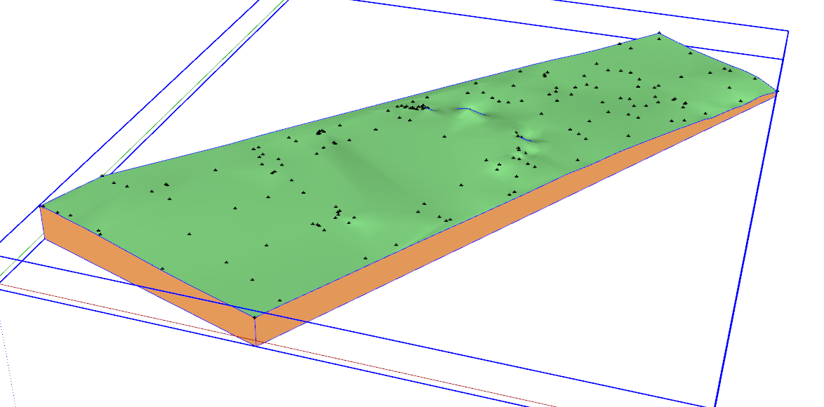
With the x- and y- values being so large the points will be a long way from the origin which could create problems so I found the minimum of the coordinates and subtracted them from the ones in the list.
This won’t change the shape. It just keeps the points in a manageable area.
I copied the numbers to another sheet in the spreadsheet and deleted the first sheet. Then I saved the file as a .csv file again.
In SketchUp I selected File>Cloud>Import.
Selected the .csv file.
No changes required in the settings.
And I ended up with this. I did not opt to triangulate the points.
I just opened it with the spreadsheet app. I’m using LibreOffice Calc but Excel should do the same thing. Double clicking on the file after renaming it shows this:
Calc will open the .txt file directly so renaming it was an added step for me. Sometimes that’s needed though.
I deleted the first column leaving just the coordinates.
As I showed, I found the minimum value in each column using =MIN(A3:A176). Then by subtracting that minimum from the values in the column, the minimum values became (0,0,0) and all other coordinates are relative to that point.