
Where did the point cloud originate from: was it collected with a LiDAR system and processed to a .las file OR did it originate from the photogrammetric processing of imagery, and then exported as a point cloud?
The file originated from a LiDAR las file downloaded from the North Carolina Data Download SiteNC Data Download.
181748_1.zip (756.9 KB)
I have not tested this theory, but I suspect the issue might be that I inserted the point cloud into a project that was started in units of inches. Could that be the case?
Wow, I honestly don’t know WHAT is going on with that file, it’s definitely units related.
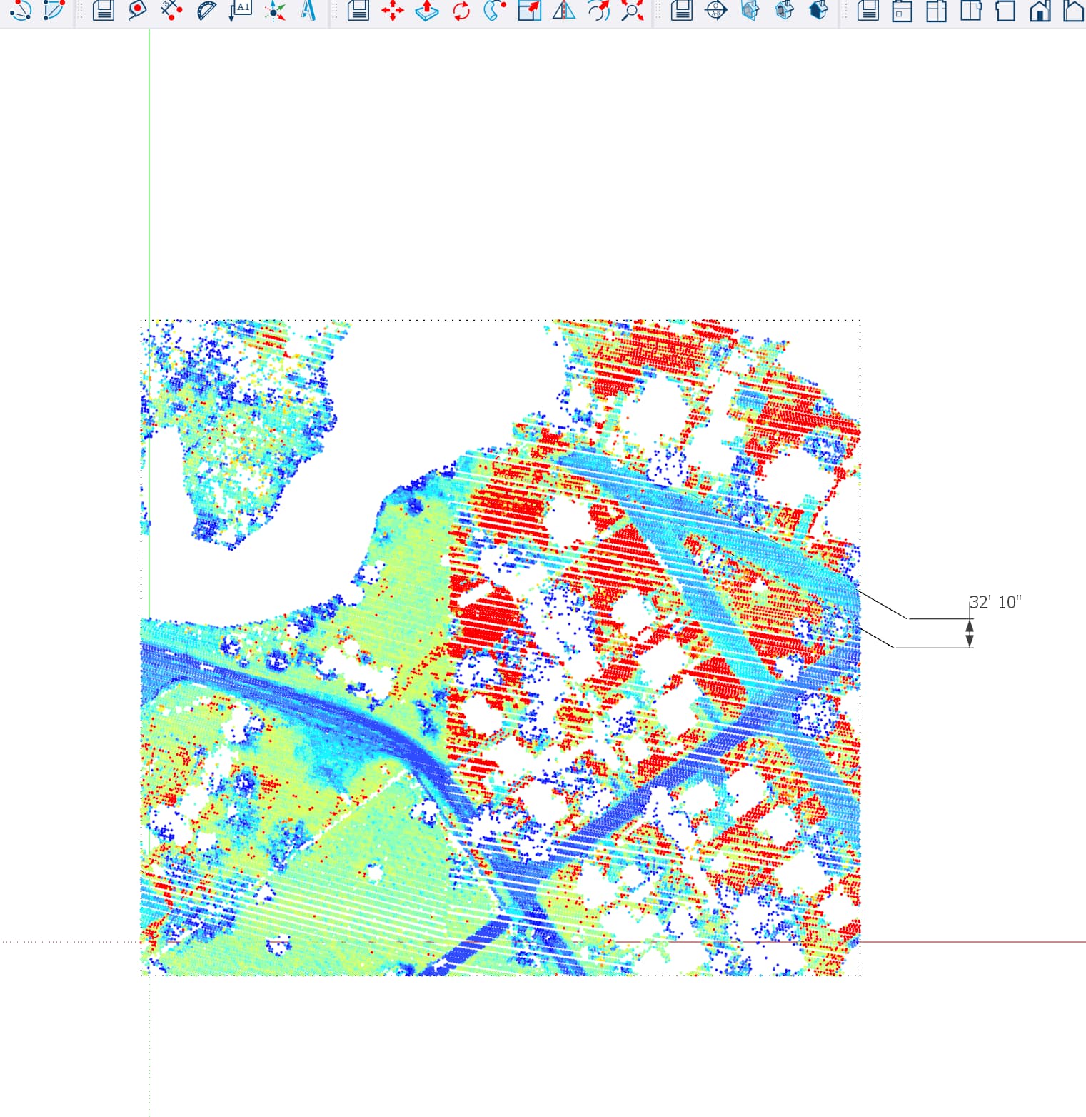
When I open it in CloudCompare no referenced coordinate system information is available but when I make a sample measurement to get a whiff of what the units are I’m showing ~30 across the street, which tells me it’s in US ft. But when I bring it into SketchUp Scan Essentials imports it as if it’s in meters…

In fact this file is really making me mad. I scaled the drawing by 3.28084x (meters to feet) and imported it, and now the value of my test measurement is correct but the units are wrong (I used the meters template):

Okay, you think, maybe we’re close. Maybe just use a different SU template, lets try ‘Urban Planning, FT’:

Nope! It just scales it to the units!!! ![]()
What happens if you set your units to feet before importing?
Liberia, Myanmar and a third country cause endless confusion to most of the world by refusing to use standard units.

- With Undet for SketchUp - the initial point cloud data must be in the metric system when you create the project.
- The scale of the point cloud can be changed by selecting the SketchUp template: metric, inches, or millimetres.