Here’s all the options I think we need for a proper dwg export:
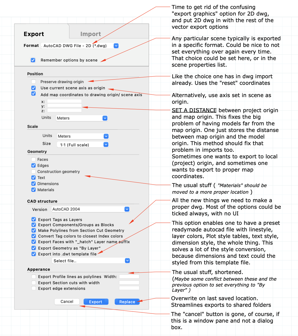
Specifically I suggest a solution to the world coordinates problem, where you can set a distance from map origin to project origin, and export out with those added distances to produce a dwg with correct map coordinates. The same method could be used on imports to avoid the sketchup problems that arise from models being a long way from origin:

