Is there a method for extracting isolines from maps? For the moment I´m doing this manually, drawing them with freehand, which is a painful process… I wonder if somebody know a more easy mehod?

I think by Isoline they mean topo lines ![]() . altitude maps. I had a German colleague who called them that.
. altitude maps. I had a German colleague who called them that.
There are a few sites out there like cadmapper that will use data from openstreetmap + other sources, but basically, outside of the US, it’s low quality at best (same with a few SU extensions like placemaker, might be great in the US, not really out of it)
Does Norway have a geographical society ? like the USGS (![]() ) or the IGN (
) or the IGN (![]() ) ? It probably does, and they might have Topo data that you can access. Might be images, might be CAD or GIS data.
) ? It probably does, and they might have Topo data that you can access. Might be images, might be CAD or GIS data.
edit :
iso lines are simply “lines of same”. Could be same altitude, or same atmospheric pressure, or same travel distance.
I mean topolines.
Enclosing an example:

I´m dragging pictures like this into SU, formatting it to the correct dimensions, and painfully drawing over the lines with the freehand drawing tool. Then correcting them one by one to the right altitude. Shitty job…
Here an example of the finished result (with TopoShaper):

yeah, personally I would do it with the standard line, I hate the freehand tool ![]()
I assume this is a screenshot of your Norge Map system. Check if they allow direct download of data or maybe svg export.
svg files are vector files, and using inkscape or illustrator, they can be converted into dxf. They’ll still require scaling, but at least they’ll be lines.
(seeing how they partially use openstreetmap, who knows, they might allow for an svg download like openstreetmap does?)
You could try this way to see if it’s easier for you:
- screenshot processed in an image editing program (I used Affinity Photo) to amplify contour lines;

your example file
- I opened the obtained image in Inkscape and with Trace Bitmap I obtained the vectorization of the lines. I saved as a dxf file;

- In SketchUp I imported the dxf file and then it is necessary to process/optimize the contour lines that are needed and delete the rest.

These steps took less than 3 minutes.
However, it is possible that it is more efficient to use the Freehand tool.
And if you have an account on that site, download the SVG directly and you should have the vector contour lines.

yes you can get svg files from various sourches, I´ll check that out a little deeper. But it`s a more complicated and timeconsuming process - what I was originally thinking was if there might be a “graphics” program that could distinguish between the lines and the backgroud color, and from there extract the lines only… for use in quick draft versions.
Thanks anyway for your response! ![]()
OK that`s more what I was thinking of. Freehand drawing the lines took the most part of an hour… ![]() - I´ll chech out your method - thanks a lot!
- I´ll chech out your method - thanks a lot! ![]()
nah, not really, even using illustrator, making vector from images is messy, and you won’t get lines, you’ll get shapes. it’s often worse. in Mihai’s example, he also gets buildings, nd pretty much everything on the image. it can be messy.
going svg → dxf → proper scale is your best solution here. unless you can directly get a dxf / dwg ![]()
Here in Finland I can go to our National Survey website and download the LIDAR and map datas, open them in a GIS application (QGIS is free) and export various things, including contours as a DXF file. There is also a commercial affordable service that delivers the data directly into applications like SketchUp, Revit and Archicad.
OK see your point. Will try Mihais method anyway to see the process. Thanks for input!
Hi Anssi - thanks - I will check more througly what´s avaliable from official sourches such as maybe LIDAR data. Thank you all - I have got many new inputs!
OK thanks Adam - will check that out ![]()
Found it - works fine - but only 2D data?
nah, it’s still the same source, the 3d terrain data is bad.
might be good in the US, no idea about the UK, but at least in france, it’s really bad.
this is the port of Toulon. it’s flat. flat with buildings, but flat. and the water is flat too.
but not in sketchup. in sketchup it’s rolling hills.

but it even manages to give me a hill in the water. because reasons.

same here, it’s a place nicknamed “la plaine” - the plain.
perfectly flat. or is it? (I checked, at the extreme points, it’s about 9m difference. instead of flat)
when it comes to 3d terrain, old or new tools are not good.
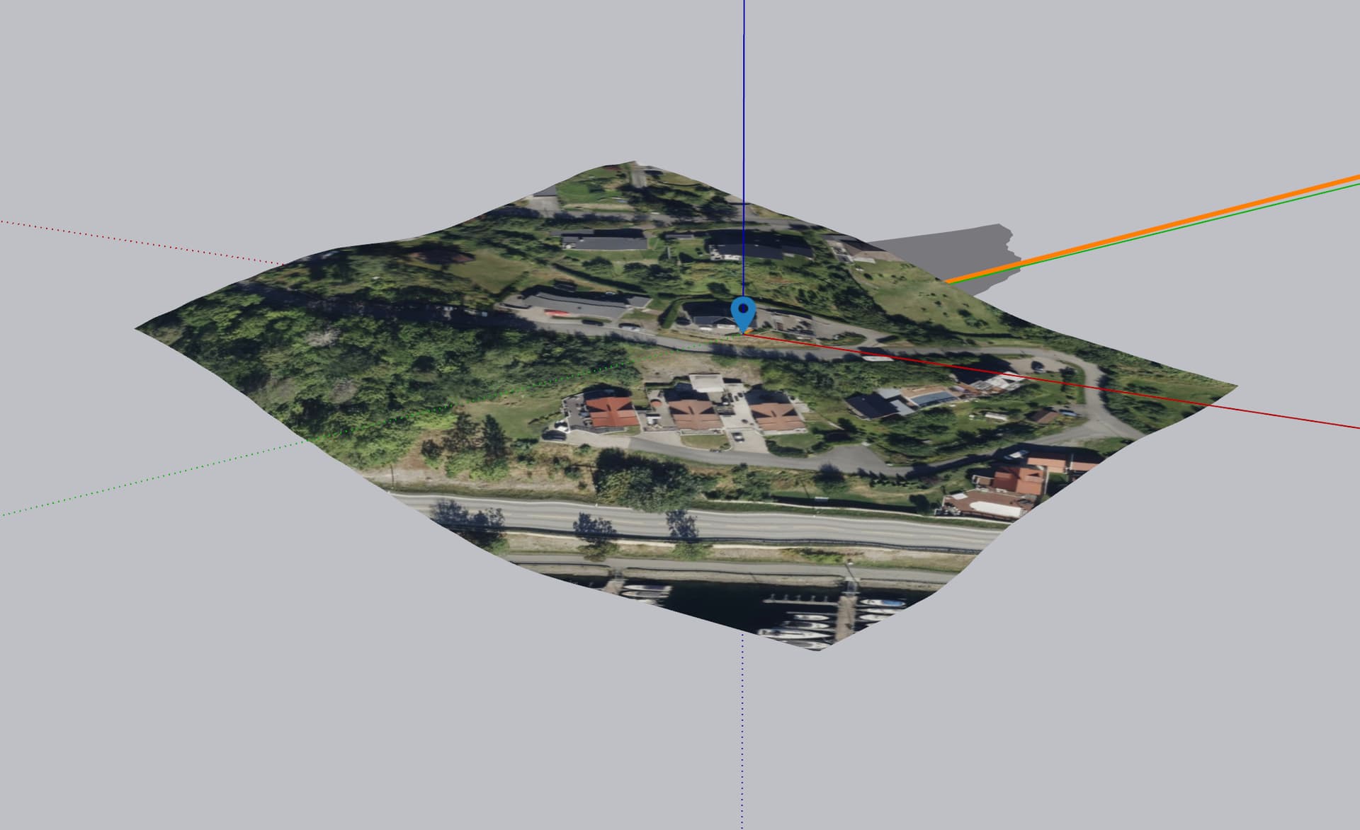
Looks like that area has poor coverage - it was barely loading any images in.
The image I took was of that area in Norway. No idea of the resolution of the topography (probably not enough height information for anything to build on!), but at least you can get more than a few polygons in.
It’s never great in the UK unless you are in London or specific bits of a couple of other big areas of construction interest.
nah, the first one is a military port, so it’s pre-pixellated ![]() the city around has good coverage, but it’s not flat. I could take the port of marseille, flat too, except it’s not. or the airport. airports are flat, right ?
the city around has good coverage, but it’s not flat. I could take the port of marseille, flat too, except it’s not. or the airport. airports are flat, right ?

no, we have good coverage, but bad 3d. if you pick a place away from cities, in the middle of fields, it’ll be globally ok, not in detail.
the 3d is about ok when you look at a city / territory scale. Even Cadmapper is doing better (not much, but still better)
the new tool brings finer 3d grid, making it somehow worse.
Yes, looks like very sparse data is available for that.
I’ll stick with the train to Marseille I think…