Hi - I’ve imported CAD into SKP before, and also CAD topographic files I’ve created in ArcGIS Pro. This time however when i import the DWG file I am seeing a whole lot of elelments stacked veritcvally on one point… has anybody an idea of what I might be doing wrong?
Cheers, Richard
Perhaps it’s the CAD file. Can you share it?
What version of SketchUp are you really using? Your profile says “SketchUp for Schools” which is a web based version for school children. Is that what you are using?
Hi Dave - its 24MB - here’s the link: Dropbox

Thanks Dave. Have updated profile. I’ve added Eneroth Flatten to Plane. Not quite sure how to run it, but reading the background info it seems to flatten everything to a single plane. This is not what I’m after - i need each contour to keep its respective z-coordinates. I haven’t run across this problem when importing DWG into SKP; can’t think of anything I’m doing differently than previous though.
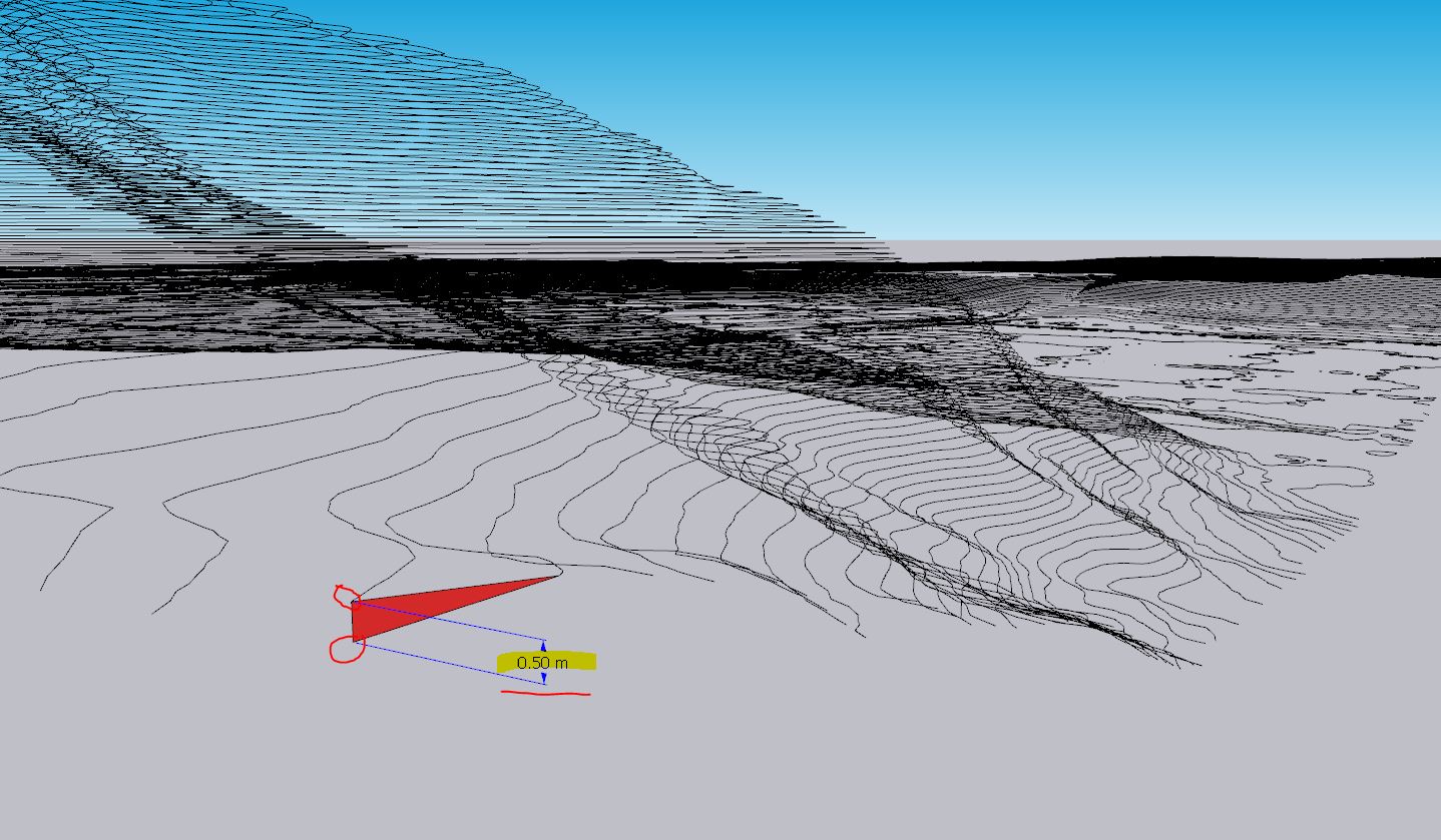
I imported the file using Kilometers in Options, and then I scaled down the model on Z (using s4u Scale extension). Depending on two known dimensions, one in plan (XY) and one on Z (distance between two level curves), you can recreate the correct model.

Repairing an imported CAD topographic file from ArcGIS in SketchUp

Hi Mihai - greatly appreciate your help. I’ve imported the DWG at km scale and can at least see it now.
I tried to add s4u Scale and am getting this query - please see attached. Can you advise on this?

I used this one - s4u Scaletool.
THANKS Mihai - this has solved the issue. I’m not sure why the z-scale was so out of whack, haven’t encountered this previously. But now at least I have a work-around if it happens again.
You’re welcome!
In such a situation, the native Scale tool can be used, but also the extensions s4u Scale, s4u ScaleTool, Fredo Scale or Curic Scale++, but the one I used is the most suitable because it is not necessary to hover the mouse over the top or grab the middle top grip to scale.
If you have access to Autocad, you can check how the model looks in 3D, in this way you can figure out if the problem with the level curves so far apart on Z is due to some export setting in ArcGIS.
Hi Mihai - I did check it out in AutoCAD and the same problem existed, pinpointing (as you say) that the issue is with the export from GIS to CAD