With a Terrain location downloaded from Geolocation is there a tool or option for changing the elevation and contours from the original geolocated area to a different amount based on my preference without distorting the surface? I tried changing the elevation using “Joint–Push/Pull” tool, it worked except the surface was distorted from the original face and after dropping it on to the sandbox surface using “Alignment Ends” tool ext and not sure if the “Drape” or “Stamp” tool from Sandbox will work between the Terrain and the
thanks, will check this, appreciate it ! I was able to figure out how to conform the terrain to the modified contours, now the distorted surface is the only problem.
Jeff
Do you mean the aerial image? Is it set to ‘projected texture’? Feel free to upload the model here or share a link to it if too large and we can take a closer look.
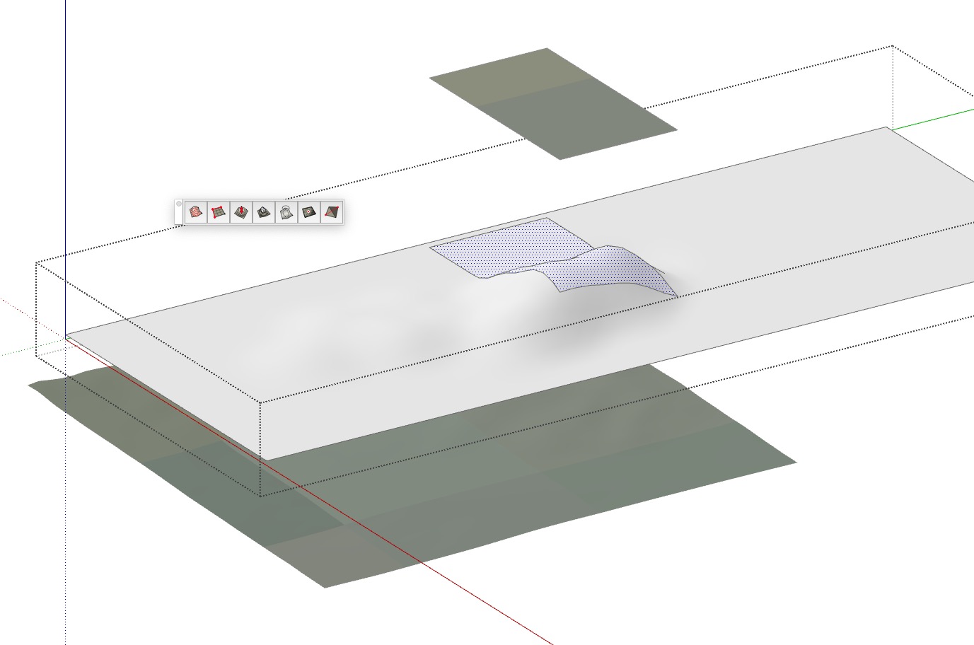
Thanks for the suggestion, I’ve tried several options to drop the texture onto the elevated sandbox white layer below. A sample of the terrain is above it. I’ve used “Alignment Ends ext (check photo), and the “drape” tool from the Sandbox ext no response, and in an earlier suggestion “Vertex and Artisen” but not appropriate for the task. I’ve used the “Smoove” and “soften coplaner” in materials tray. The closest to working is the “Alignment Ends Ext” but the texture image (a Geolocation image download” is distorted after its dropped via Alignment ends ext onto the elevated surface. The terrain matches with the contours but the image texture is distorted. A file of my model is uploaded to be able to possibly figure it out. Thanks
I also tried “projected” option from right clicking on the terrain, but “Texture” which normally shows up with “positioning” or “projected”, but the option wasn’t available maybe because of the incompatible terrain
I think it may be best for you to start again in a fresh new file. Save this one obviously but the first issue I see is that you’re working off to the side and therefore no longer registered to the site’s geolocation.
If you want to drape an aerial over a new terrain, instead move the terrain under the existing aerial.
Maybe I misunderstand, is it that you don’t have flat imagery for this, only the other terrain? For a texture to be projected it must be applied to a single flat plane. A process for achieving a passable version if I understand your problem correctly. First I scale the existing terrain to .001 as flat as I can get it to minimize distortion while keeping the UV mapping. Then I transfer the image to a flat rectangle, set that to Projected and use it to transfer onto the new terrain. It’s a shame you don’t have this image as a flat image already but this is very close to the same.
Yes, that was my first assumption The image was directly downloaded from Placemaker. I’ll try to redo the elevated terrain to .001 levelness that might be acceptable for the projection and see if that works. And the earlier suggestion to changing the terrain under the ariel and then draping, then paint from sample onto the terrain again. Will let you know how this works out, hopefully successuly thanks Jeff
I watched the entire video instructions, and its clear and easy to follow, I’ll try this approach I know there are plenty of options now. Thanks alot !
I’m not sure about surveys, but the terrain was downloaded through “Placemaker” program which works with “Revit” and “Sketchup” The terrain location was found through the search bar in Placemaker and selected, then downloaded. I found hat terrains such as from “Digitable globe” is difficult to modify and as mentioned not easily compatible in the project.
The project I’m working on will ultimately use all the raw materials from Sketchup tool bar to re-create the same features as the copied texture image. I’m just using the copied image to redo the contours and higher elevation for another landscape but without the copied image.
I’m just referring to accuracy. For a real project that will actually be constructed you cannot rely on that type of information. You would have a licensed land surveyor provide actual data collected from the site. For projects that are just for fun or hobby then it is fine.
Thanks, its just for a hobby and fun. And since the land is modified to different contours and different elevation of my preference with some random, accuracy is not important. Thanks !