Hi I am wondering if there is 3D data available for all countries?
I´m trying to do a 3D Mesh for a place in Iceland by using add location and it always shows up in 2D, is this because there is just not data for this specific place yet?
Hi I am wondering if there is 3D data available for all countries?
I´m trying to do a 3D Mesh for a place in Iceland by using add location and it always shows up in 2D, is this because there is just not data for this specific place yet?
What part of Iceland are you looking at? Did you choose to includethe 3D Mesh in the Add Location settings? Are you turning on the tag(s) for the 3D mesh in SketchUp?
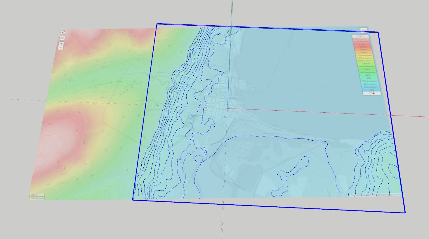
I tested it with a random location marked by the orange pin here:
Here’s the 3D mesh after import.
I suppose there might be parts of Iceland for which terrain data is available but there’s at least some.
Hi Dave and thank you for the replay! I think I am doing everything correctly, I have also tested other places in Iceland like for example Reykjavík and another town called Akureyri and then it workes fine but the location I need it for is a part of the town Dalvík and there it always comes out flat, also tested for another small town and it came out flat aswell. I have tested both Bing and Digital Globe.
Yes exactly Dave, but okey good to know that it is not me doing something wrong at least ![]() Thank you for checking it out ! Hopefully the data will come for more rural areas in Iceland in the coming years and I will just have to do it the old way this time …
Thank you for checking it out ! Hopefully the data will come for more rural areas in Iceland in the coming years and I will just have to do it the old way this time …
Do you know if it is Bing or Digital Globe that are “to blame” or is it perhaps the municipalities in Iceland that have to provide the data and the reason it is flat is because they have not provided it yet?
all these services tend to have similar / the same sources.
this would indicate there is a missing spot in the collected topography, maybe they didn’t collect this particular place, maybe it’s corrupted.
I wasn’t sure they use the same sources, since there are/can be huge differences in the results. Anywho, now we know ![]()
well cadmapper is based on data from openstreetmap and the usgs.
openstreetmap uses all sort of ressources including bing and maxar (digital globe), both sources used in sketchup.
Because the OSM dataset has been upgraded by users and companies and other sources, I usually find it more reliable than the native location tool in SU, but with cadmapper, no satellite view. and that’s super helpful for stuff like roofs, plantations and such details.
There are some pretty big holes in the terrain data around Iceland, it’s very area-specific though (e.g. Dalvik and the whole valley going inland is missing, but the nearby settlements of Arskogssandur & Hrisey have good coverage.
The terrain data has nothing to do with Bing or Digital Globe - the “Map texture” section has no effect on the 3D mesh, so no need to try different settings there!
The elevation data is not provided by municipalities, it is sourced from data sets such as satellite/aerial scans.
I’ll get issue raised with our data provider to see if there’s any improvements that can be made for this area.
btw, if you use the “geolocation” tag, then staff are more likely to see your post as they have saved searches on relevant tags.
Dan
Thank you mihai.s that is my plan now, just more time consuming … ![]() … but well well
… but well well ![]()
Thank you Daniel for this informative response! Would be great id you could do that, raise the issue that is, especially if it would lead to some improvements ![]()
Today, many national survey institutes make their data available free online. This is usually much more accurate than satellite scans. I don’t know the situation for Iceland. You usually need to use a GIS application (QGIS is free) to convert it into a form usable by SketchUp.