I’ve been trying to help a fellow employee with a KMZ file, everytime he places the model, anything below the Google Earth is unseen unless the model floats above the geo location. is there a way to cut drape in Google Earth, so that it can be seen?
The following is his issue as presented to me:
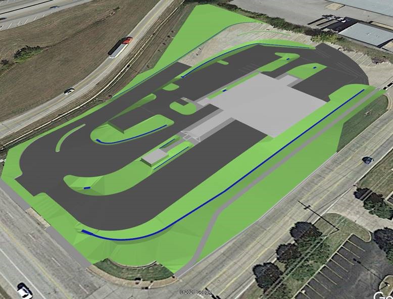
Here is my issue and questions:
I create a 3d kmz google earth surface file for my site for display of the pavement, side slopes, ditches, building pad, etc. If that surface is in “fill” and is above the google earth surface it shows up great. See following snipit
However, if any of the kmz surface is below the google earth surface, it does not show up as seen in the following snipit where I lowered the kmz surface to be both above and below the google earth surface.

Is there a way to trim a hole in the google earth surface model (or some other method) within the limits of my kmz google earth import file so that my model will show up in both “cut” and “fill” ?