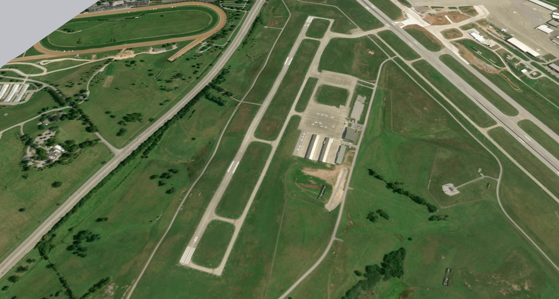
I’ve imported terrain from Digital Globe, and for whatever reason the Runway for this airport came in extremely “lumpy” and the elevations from one end to the other are pretty far off. I’m fairly familiar with the “smoove” tool, but it’s going to be really difficult to push and pull the terrain the entire length of the Runway to make it a gradual slope.
I need one end to be 30ft. higher than the other end with a gradual slope. Is the “Smoove” tool the only way to accomplish that? Or is there a way to draw a rectangle the same dimensions of the runway with that 30ft slope and then place the terrain on top of it somehow? Maybe purchasing Artisan would be better?
The number of terrain points doesn’t change when you do an import. If you import something that is a mile across, I think that you get 1500x150 terrain points. If you did a quarter mile you would get 1500x1500. Importing a smaller area and then using the Add More Imagery… to get the other areas, may give you better terrain.
Here’s a test with Boulder airport, one file imported as a single grab at 16X, the other as four grabs at 18X. Might not be as noticeable a change as with the airport you are importing.
It’s Blue Grass Airport in Lexington, KY. It’s a pretty big airport with 2 Runways and I need the terrain resolution to be pretty good for what I do. So I imported maybe 40 individual screenshots at 18x. So probably the best the terrain is gonna get from importing, yea?
Ok this looks like what I’m looking for thanks! At what point did you get rid off all the waves in the runway? It’s kind of hard to tell from your demonstration what step that happens in.
Right click on the animated gif > ‘Open image in new tab’ to see it at full resolution.
Look carefully, right at the beginning, after you unlock the terrain and enter inside the group (right click > Edit Group), select the area you want to flatten and use what you have available, Scale tool. I used Artisan > Make Planar, but you can also use a lot of other extensions, Fredo Scale, Vertex Tools, etc…