I do hazard research about volcanic buildings, and to do so I use large amounts of data, collecting pictures of the volcano fields, 1 km sq at the time, Tungurahua (Ecuador) Barú (Panamá) take more than 60 pictures, and the capture of it is miserably painful, as you know it’s really hard to place 2 pictures aside, just imagine when you have to place them 20 km away from each other. So, I must admit that is pretty challenging and rewarding, and maybe a cure for alzheimer’s too.
I’m wondering if is it’s possible to capture large areas and how to do it?
Thanks for your help.
Skype oscat57
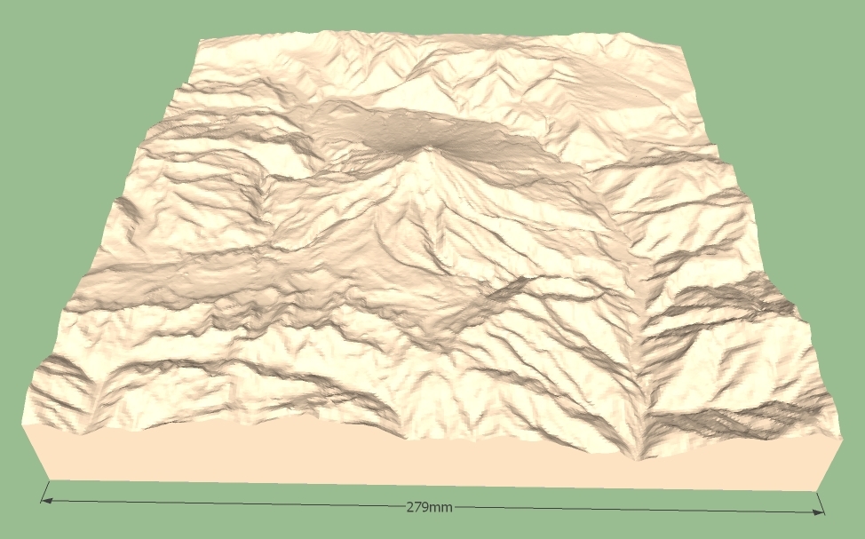
Terrain2STL generates large stl-files which can be imported in SketchUp.
If texture is needed this must be added afterwards.

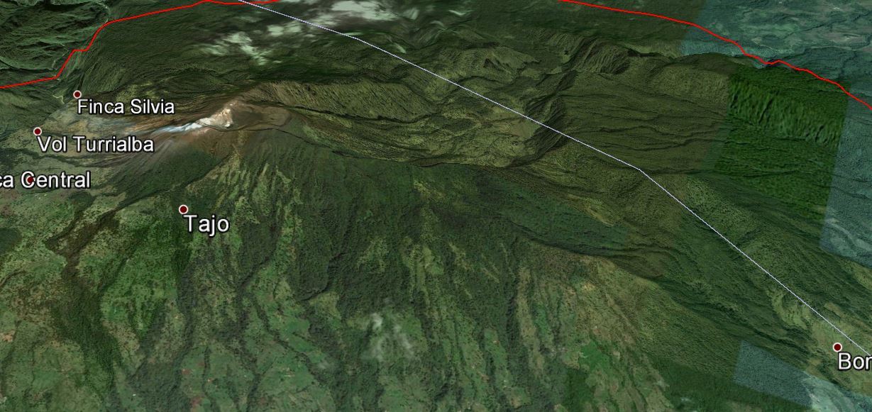
Tungurahua is in the center.
The file is to large (7700kb) to upload here, but very easy to generate.
2 Likes
Great advice.
Thanks


Hi Mike
Definitely it’s a great help.
It is possible to increase the resolution ?
Image wise, you can get fairly high resolution image from google earth pro which is free. I believe larger than 4000 px across per image which you can stitch, but it is larger than what sketchup offers.
From what it looks like, the STL file is generated from google. Third party application using google data are somewhat limited in producing good resolution data compare to their native software google earth.
I believe that this website uses data obtained here:
http://dds.cr.usgs.gov/srtm/version2_1/SRTM3/South_America/S01W078.hgt.zip
These are files that contain 1201 x 1201 height values for each 1 x 1 degree tile. This works out to 3 arc-second data (or approximately 90 meters between datum points).
1 Like
Thanks for the explanation @jimhami42 ![]()
According to the docs on the Terrain2STL site, this is the source of the data. However, I had the wrong file … it should have been S02W079.hgt.zip.
I downloaded the file and imported it directly into SketchUp using a 1-in-8 sampling (150 x 150). The data format reserves -32768 as the indicator that there is no data available for that node, but I had not encountered any of these holes in previous files I’ve imported. However, the data for this area looks like Swiss cheese:

I also imported a 300 x 300 grid roughly centered on the volcano using the maximum resolution of the file (this is the same result you get from using the Terrain2STL website):
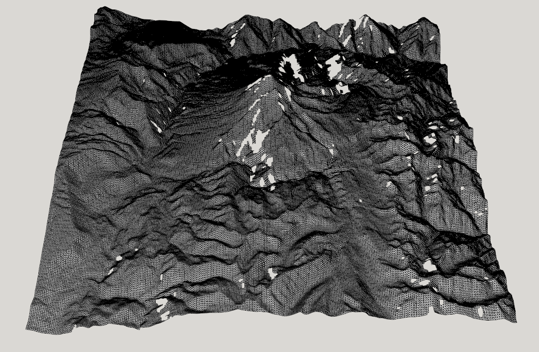
I suspect that there is higher resolution data available from another source. Most of the ones I’ve found are not in English and, even with Google translation, I’m not sure what I’m looking at ;(
Holes can be caused by to little geometry. I wonder why this stl-import is error-free.
The new version of terrain2stl is really good !
With the earlier version last year I had a lot of trouble (austrian alps).
http://goisern-sketchup.npage.de/neuigkeiten.html
1 Like
Yes, they can. However, the file I downloaded from http://dds.cr.usgs.gov/srtm/version2_1/SRTM3 has raw data containing numerous values that equal -32768 which represent a void (probably caused by water). This has nothing to do with SketchUp.
Because it’s been repaired … I left my import as I found it.
I think it’s really cool ![]()
1 Like

Last year looked the result like this (in netfabb): the red parts are holes. Little holes can be closed by netfabb or meshmixer and so on, but to close a hole where a mountain should be, that was not much funny.
Shows how much better the new version of terrain2stl is !
I agree ![]() It looks like the author has made a number of additions in the last six months or so. Here’s the current To-Do List:
It looks like the author has made a number of additions in the last six months or so. Here’s the current To-Do List:
 [x] Make dataset voids not just a fixed negative value.
 [x] Make models watertight.
     [x] Fix voids in edges of models
 [x] Increase maximum box size.
 [x] Fill voids in dataset.
 [x] Make the 3 arcsecond resolution available in all sizes.
 [x] Add ability to cross tiles. !!!
 [x] Make Print and Download buttons disappear or defocus when the selection box is moved
 [x] Make the selection box reflect changes in the Lat/Long boxes
 [x] Decide on a maximum file size and/or compression
     [ ] Add a resolution slider
 [x] Add longitude compensation to correct for the distortion caused by the Mercator Projection
 [ ] Draw the northern and southern boundaries of the data set
 [ ] Normalize model height to remove vertical offset
 [ ] Change view to fit lat/long
 [ ] Vertical scale slider
BTW, the author enhances the vertical scale a bit per the comment:
//float true_verticalscale = 92.7; //meters/arcsecond at equator
//old vertical scale was 23.2
float verticalscale = 92.7;  //true_verticalscale gives models that are too flat to be interesting
Hello Miller!
How do you open the Terrain2STL file in Sketchup? I tried importing the .stl file in my Sketchup, but that option doesn’t exist.
And how do you add the real-image texture of the site afterwards?
Thank you!
Hi Sophia
You need to export the *.stl file as *.dae format using Meshlab app.
Find Meshlab on download.com ore file hippo.
Best regards
Oscar Aguilar
antico design group
8807-9990
Hi Oscar!
Thank you so much for your advice, I’ll try that! Do you happen to know how to add the real-image texture of the site afterwards? When I open the terrain as a mesh without the Google Earth texture
That’s a very complex subject.
There are several videos on YouTube about that
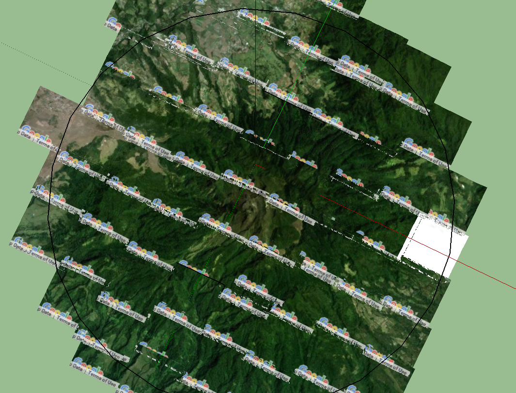
Google Earth let you capture a wild size images so you just adjust the image to the terrain.
The painful part is that we can avoid the learning curve
Check out YouTube, there are many videos and hopefully you will find one that suits you well
Oscar Aguilar
antico design group
8807-9990
There is this extension that does import and export of STL:
https://extensions.sketchup.com/extension/412723d4-1f7a-4a5f-b866-281a3e223337/sketch-up-stl