Can anyone convert a Shapefile terrain contour lines file for me for import into SketchUp?
I installed and tried to do this with QGIS, but the converted file is a 2D flat dxf with no topography when imported into SketchUp.
I will provide the shp files if you can send me a working 3D dxf or a SketchUp document.
Have you tried this method yet? If I have time later I will test as I also use QGIS and haven’t made the effort yet to preserve Z-Values when exporting.
Ok, so finally tested it myself and it works great. See videos below showing the process. Glad to add this to my toolbox as well ![]()
Adding Shapefile. Running ‘v.to.3d’ from the Processing Toolbox/Grass/Vector menu. Then exporting the new ‘3D’ layer to DXF.
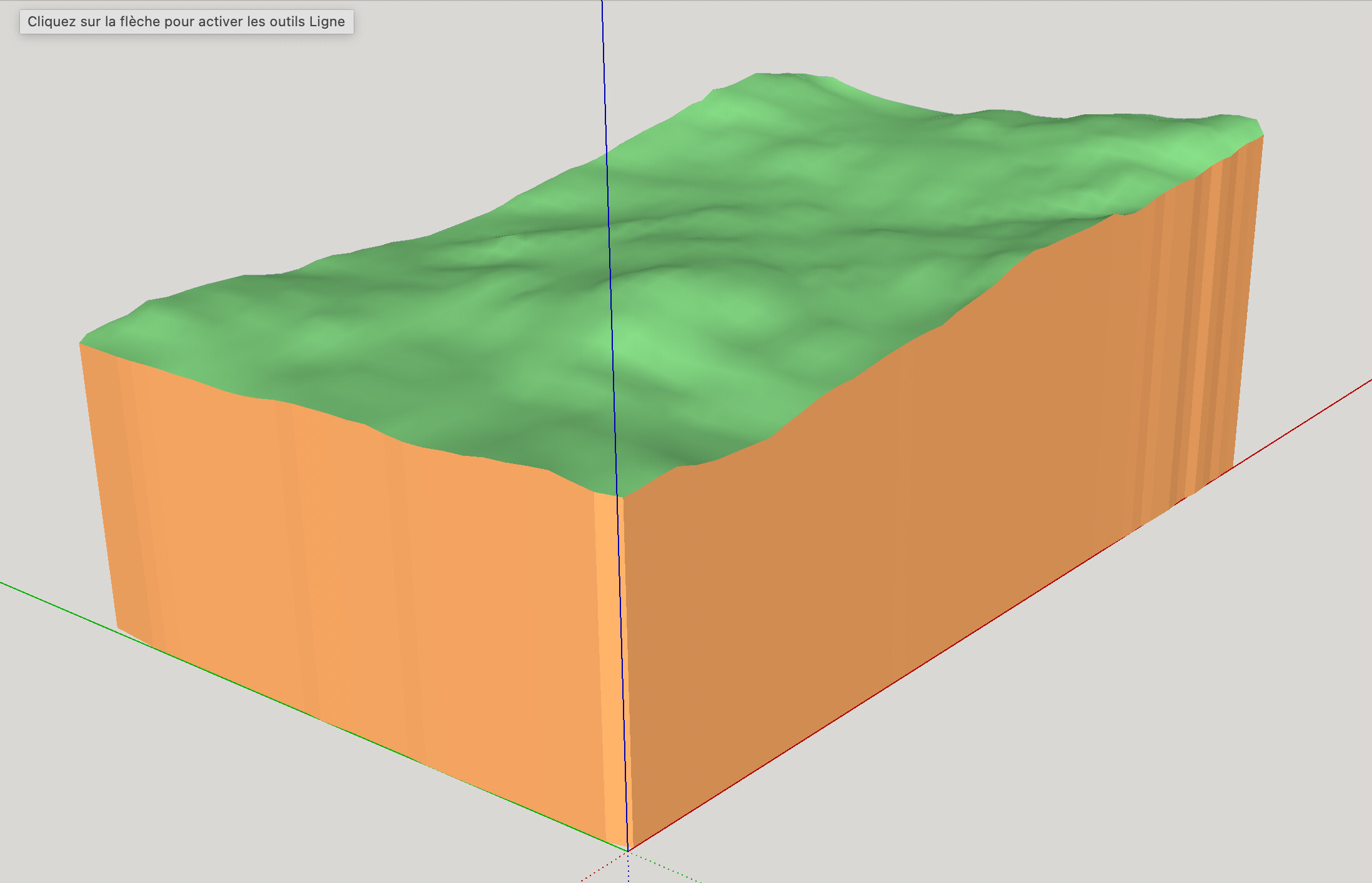
Importing the DXF into SketchUp…it’s such a large area that it’s hard to see the 3D until you zoom in. Ran Sandbox from Contours to give some of the contours a mesh. Exaggerated the vertical scale to make it more apparent.
*note that the video capture somehow cut off the beginning of the process so let me know if you need a step explained in more detail.
Thanks for all of this. I enjoy the videos. Very useful.
I must say that I am not a geomatician, even if I have some notions. I downloaded QGIS and tried it for the first time last week and found the learning curve to be quite steep.
My project is to design and build a house and I needed a 3D view of the land to decide on a layout plan.
Here is a first test image with the TopoShaper plugin.
Looks good. How did you get the contours/terrain surface without the shapefile data?
Frankly, I don’t know how to create surfaces with the open curves. I am new to GIS and I know little about Shapefiles.
In SketchUp, I did not use Sandbox. The render was done using only the TopoShaper plugin. But it is too soft for my taste. I will try different settings.
