I’ve seen a few tuturials, but when I try it, I don’t see all the same options/ buttons…
Anyone have an updated method for placing a model inside Google Earth, so that a customer can see a new house, with respect to 10 mile area of site?
Separately, is there a non-Google Earth method that might be simpler?
Thanks!
placing models in Google Earth isn’t feasible any more.
Alternatively you could use the native “Add Location” functionality of SketchUp Pro.
If you need some buildings around or high res stuff etc., you may want check the PlaceMaker plugin ($).
Hi @randyl,
If you need to spin around the model and/or see lots of surrounding context, then viewing in GE is probably the best method. If you’re just wanting to see one particular angle, you can use your site photo and bring it into SketchUp as a Watermark background for your model. Here are both ways to do it:
- Google Earth Method.
-
Make sure to ‘Add location’ so that the coordinates are registered. Move your model to where it should be on the aerial (don’t move the aerial to the plan). If you’re worried about moving the model then make a copy of it first.
-
I recommend moving you model up slightly above the ‘Location Terrain’ so that once in Google Earth, the surface won’t be covered by Google Terrain mesh.
-
Turn off or hide any tags that you dont want to show in Google Earth and export the file as '3D Model and choose ‘KMZ’ for the format.
-
Import the KMZ into Google Earth. Here it is…not perfect but it works.
Method 2: Bring Google Earth/Street into SketchUp (I like this method better as when you get in close to Google Earth it gets all distorted). *(note confirm googles terms of use…If you’re just showing a client you’ll likely be ok but you can’t use Google imagery for commercial purposes).
-
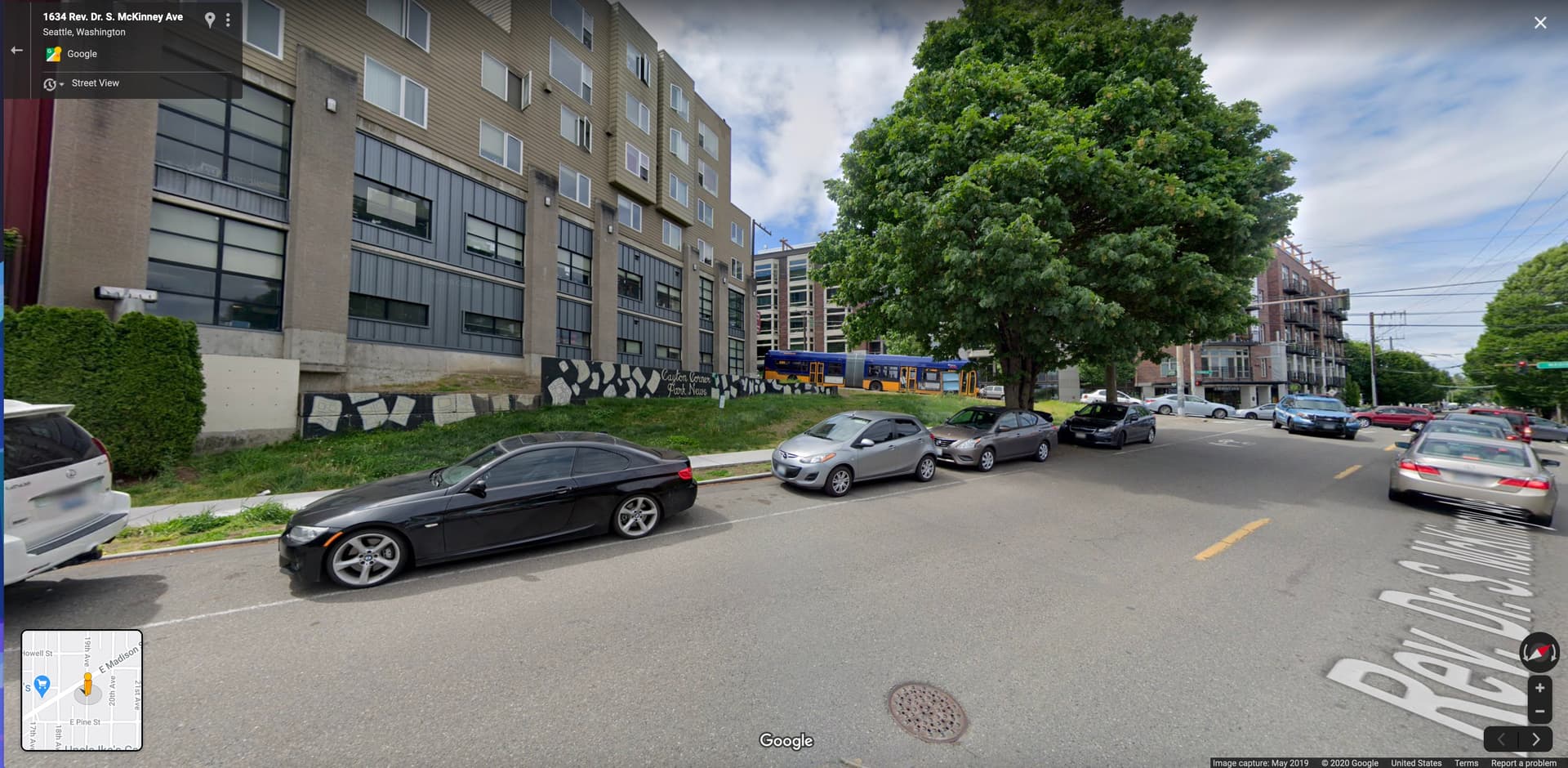
Use your own photo or capture a screenshot of the angle you want to place your model into:
-
In the Styles panel in SketchUp, add this image as a ‘Watermark’ and set it to the background and rotate, pan, and maybe adjust the camera’s FOV to get it to line up best you can. To get fancy, you can have two watermarks, one in front and one in back like I have here so that the cars and existing tree actually ‘cover’ my design model. *note I’ve faded the watermarks so that you can see them better compared to the model.
-
Here is the final view. Repeat process for multiple views making sure to save each as a new Style:
Agreed that it is less feasible than it was before when you could simply push the ‘send to Google Earth’ button…but the extra step of saving to KMZ isn’t that difficult or time consuming.
It should also be noted that this will be in your local instance of Google Earth. Google cut off the ability to upload files or “big” GE quite a while ago.
Thank You for showing these methods.