Cloudcompare is perfect! You can convert the point cloud to mesh easily.
Also there is a new plugin if you have iPhone or iPad with LiDAR from PolyCam. You can insert your point clouds taken with your device directly to your model.
Working with Point Clouds accurately on a Mac always seems challenging because of the limited Point Cloud software available. I occasionally use the services of an old, stuck in his ways, draftsman who only use Vectorworks on a Mac. Our workflow is that I upload the Point Cloud to OneDrive and send him a download link, which is pretty straightforward.
The difference with Vectorworks is that the Point Cloud becomes an integral part of his project file, whereas with SketchUp (at least with Undet), the cloud is only referenced as a linked file. Depending on project requirements, I sometimes crop the Point Cloud before sharing it, or sometimes I send the raw scan for him to crop as necessary.
The draftsman then develops models based on his best guess of where the point cloud surfaces are, but the resulting accuracy is not really accurate enough. Once the modelling stage is almost finished and the key areas identified, I generate meshes for those areas and send them to him as a SketchUp file which enables him to extract sections and refine his model.
I hope that’s useful, I don’t know anything about Scan to Design.
The ideal solution is for me to buy the guy a PC and teach him SketchUp but he isn’t interested ![]()
CloudCompare is more of a point cloud management software. If you need to segment, classify, remove unwanted or unneeded points, fill in holes, etc., it’s great. Its also great for terrain and terrain byproducts such as elevation contours and even a mesh from a subsampled point cloud, but in my experience if you’re looking to a manmade object its not the best option.
I have tested a lot of point cloud software that makes claims of feature extraction thats simple and accurate, and I’ve yet to find one that works as advertised, mainly because so many people are using so many different caliber scanners these days. That’s why Scan Essentials makes the most sense for me: I’m faster at manually modeling off a cloud.
I know a couple people using Vectorworks, and the one model a received and imported into SketchUp wasn’t helpful as a starting point. I basically chucked it and started over from scratch.
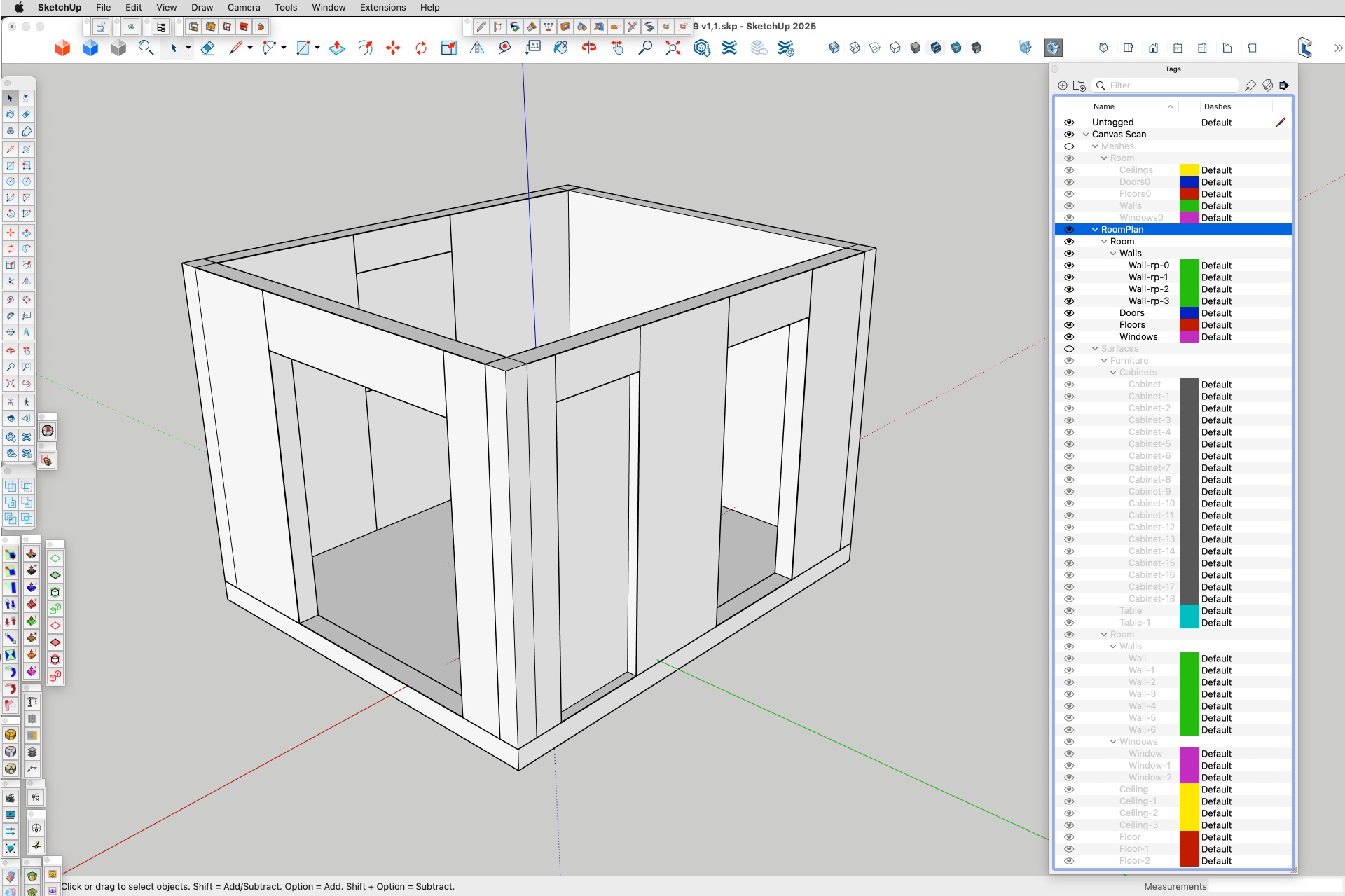
Scan to Design is a part of SketchUp for iPad. If you have a Pro subscription, it comes with it, but you need an iPad with LIDAR capability. It only operates on the iPad, but once you’ve made a file, you can then transfer it to desktop and work on it more there. Since getting a new iPad Pro last November, I’ve only tried it a half dozen times. Here’s what I got with my first try with the Outliner open:
Surfaces:

Abstracted walls auto generated:
Meshes:
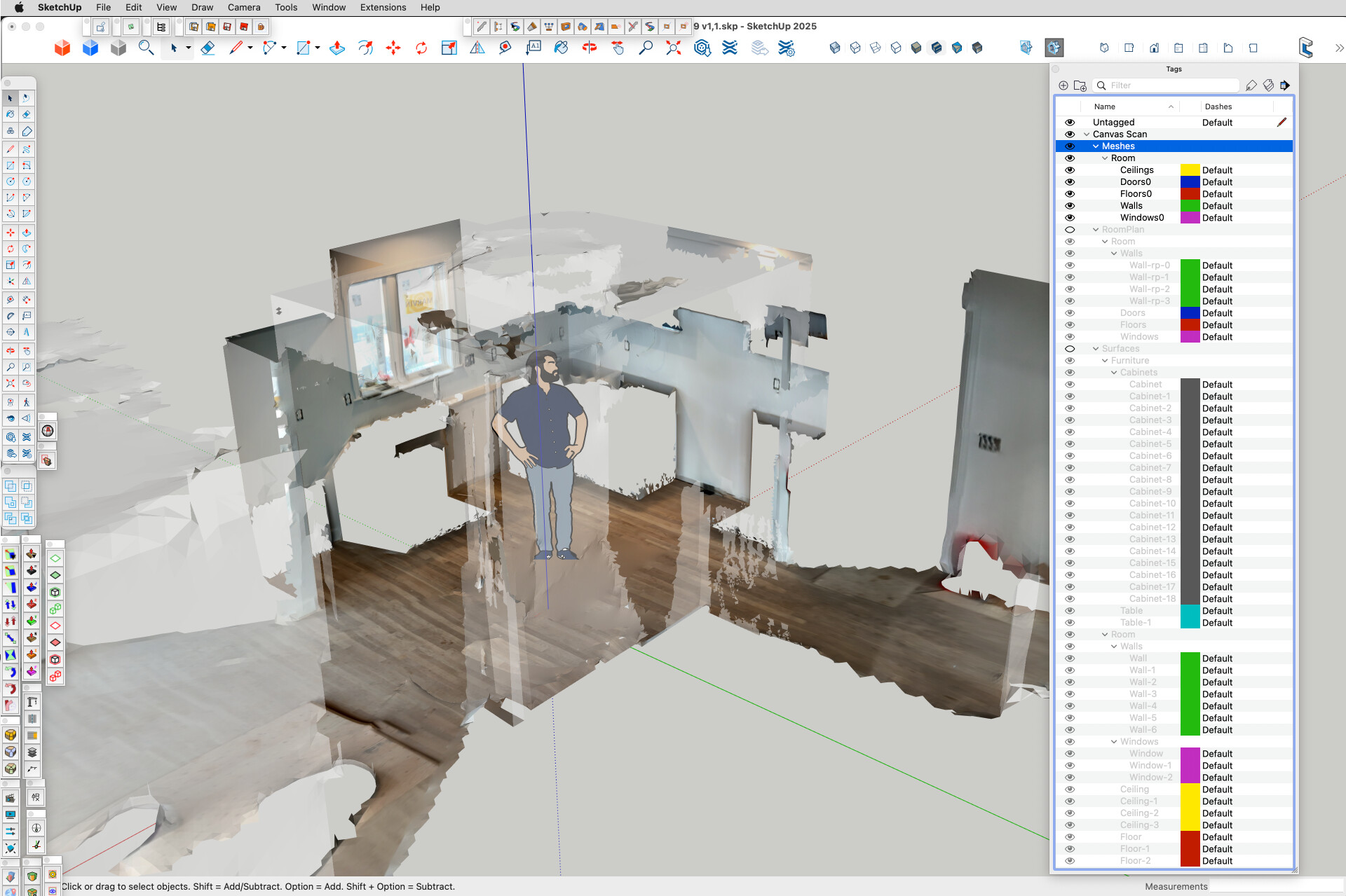
It does seem to project the pixels from the photo onto the mesh and the surfaces. I don’t know where, if at all, you can go from there as far as projecting textures goes.
Just going over old ground but the Undet Plugin Feature Extraction Tool is literally millimetre accurate and it couldn’t be simpler to use.
I 100% agree with that, but fortunately the workflow I described doesn’t involve me needing to import his model back into SketchUp, as he creates the full project including design, manufacturing and setout drawings within Vectorworks. In a way its the other way around - I am sending him Point Cloud information generated within SketchUp to make his Vectorworks model accurate.
That looks very cool.
I know you said its not that important but I wonder what sort of accuracy you are you getting on your model?
I haven’t really had the opportunity to sit down and really concentrate on an experiment yet, especially in comparison to my Match Photo workflow. Maybe I can finally do that in the next few weeks.
Just following on from my last reply - I have shown a quick clip below of the Undet Feature Extraction Tool creating a mesh of the wall next to the open door. I increased the clip speed by 1.5x to get it within the 16MB upload limit but you get the idea. The resulting mesh has just over 19,000 polygons and the resulting Group is perfect to take a section from using Create Group from Slice.
You would actually see each brick in the section ![]()


This is an example scanned with my iPhone and exported to dae with Polycam
12_4_2025.zip (8.8 MB)
Another one exported to usdz
18_5_2025.zip (7.5 MB)
Classified - what does that mean?
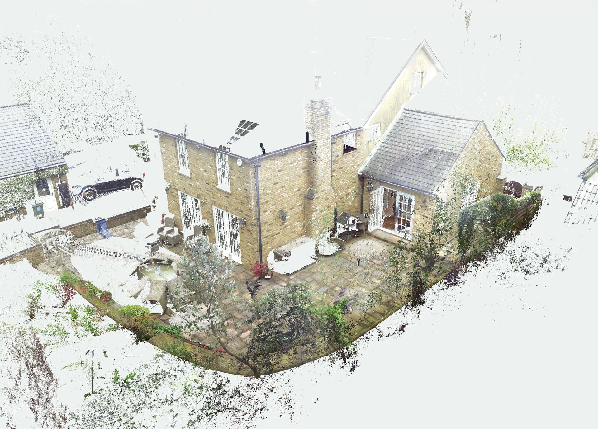
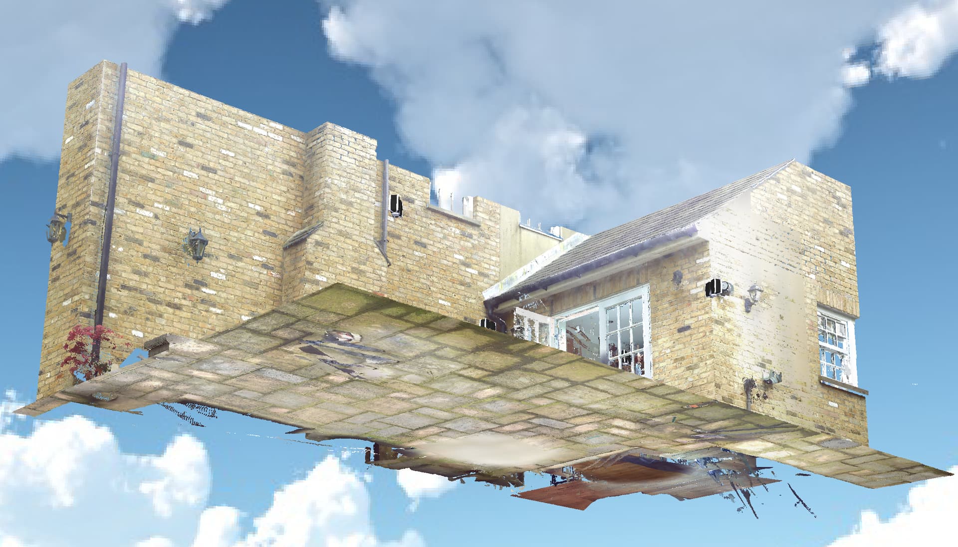
The scans were taken with a Leica BLK 360 G2 and the point cloud was edited and published using their Cyclone software.
Hi,
I dont understand why it’s not working. Just to be sure, could you try on the link in this topic 🌕 Turn Images or Video to 3D with the new SketchUp Gaussian Splat extension🌕
That should be the same.
Regarding the projection with ground mesh tool, you need to rotate the point cloud in another software and then import it inside Scan Essentials.
In a point cloud you can classify each point by scalar factors. It consists of separating the points depending on their type. For example, land, building, vegetation, etc. If it is classified, you can hide part of the cloud to work with the points that interest you the most.