Sketchup 26 large area terrain failure

I have had the misfortune of using sketchup 26 and its exactly as bad as sketchup 25 with regards the area I try to use, even though the problems have been there since sketchup 24!

I have had support and these problems have been known for a long time but I was told to post it on here as it might get more attention.

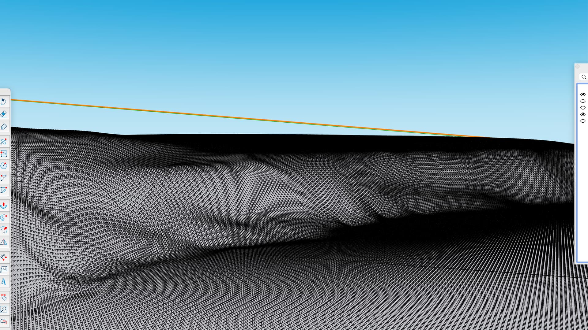
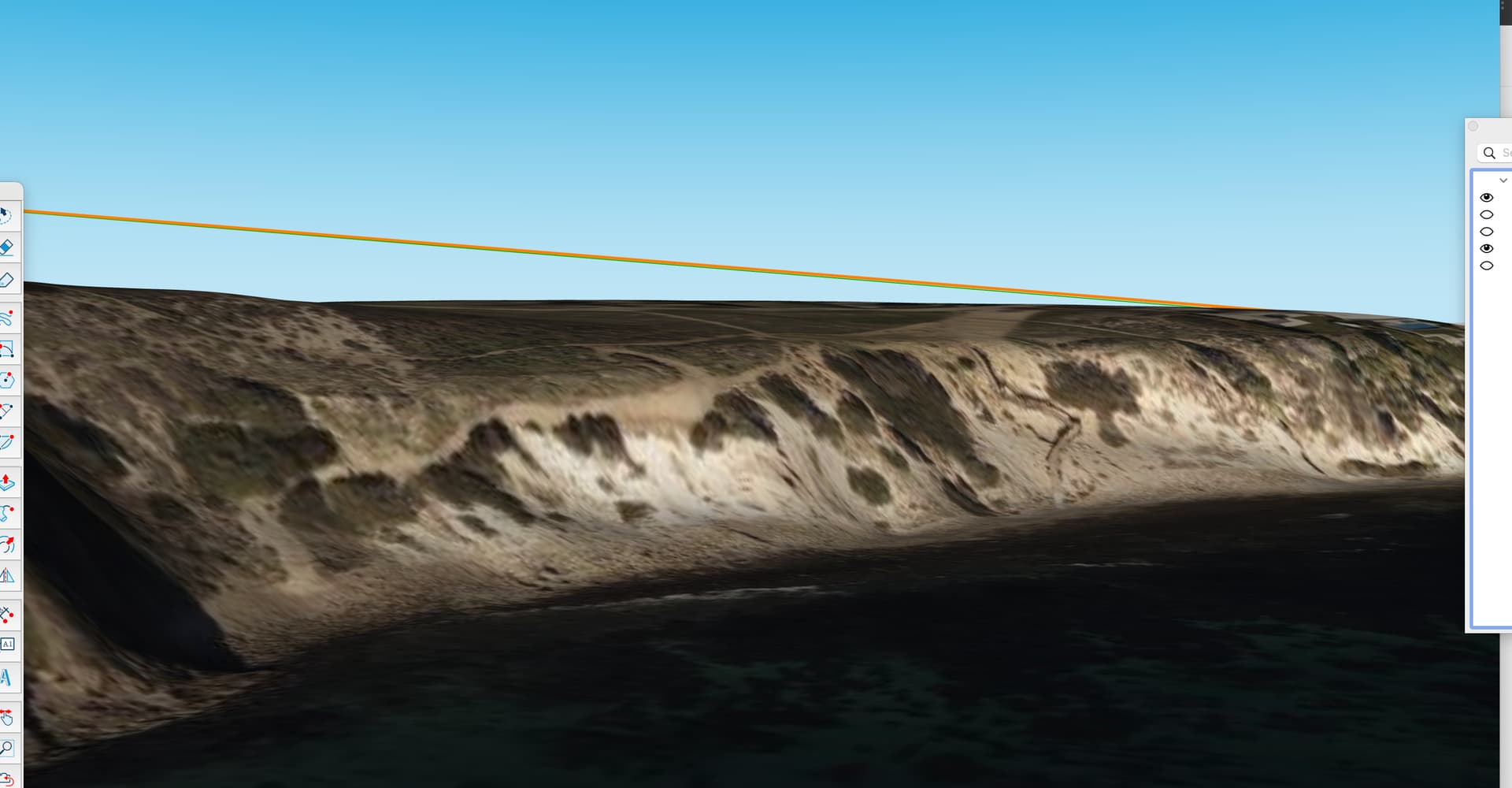
If trying to create large areas of terrain for real-time use it will crash, continually, if terrain is created (you have to very much limit the size of area) it creates if incredibly high levels of polygon content (as low, medium, high is way too crude). Low creates millions for just a 11km x 8km area)We use Skimp to reduce the output by 99%.

The texture patterns created are unusable as they are all ridiculous sizes such as 2050 x 2050

1794 x 1282 2050x1538 etc etc all being resized, upwards and wasting capacity..

Other problems are as below

Sketchup 2026 problems and improvements required.

1/The ability to go higher altitude and define one box containing all terrain required. Instead of having to keep pull the box out and up and down etc etc. At the moment it stops of an indicated altitude of 200m (which is blatantly incorrect)

2/ A counter is needed, that as you expand the area selection box, tells you how many maps and polygons will be created as it goes.

3/ To be able to define not just low, medium, high but a 0-100% polygon count level that can go properly low and the same for maps. At the moment an 8km x 11km area can often create 2-3 million polygons and hundreds of maps, we have to then reduce it to .5% (using skimp, which is equally unreliable) of that size to be able to use it.

4/ Due to the immense sketchup output content size we can’t create one area in one go, but have to create many and joining them in our modelling tool.

5/The ability to be able to create 4096 x 4096 patterns and correct size patterns.

6/Add Location should ideally start at the last place you were working on.

7/ Why is the true north offset never 0? And, always changing? There could perhaps be an option for a flat earth.

8/ After you have set geolocation, you get a page titled Model Geolocated. What is the point of this page?

9/ All maps created are incorrect and illogical sizes i.e. ones labelled 2048 are always 2050 etc , others are weird sizes such as 1794 x 1282!,

2050 x 2050, 2050 x 1538, 2050 x 514, 1282 x 514. They should be 2048 x 2048, 2048 x 1024, 512 x 512, 1024 x 1024 etc.

These are not acceptable on some visual systems or are resized and use a lot more memory than correctly sized ones would.

10/ If sketchup created proper size maps, and, if they were numbered in a logical naming system, i.e. going across in lines with names such as A1,A2,A3,A4,A5,B1,B2,B3 etc I could take them, join them and create useable patterns including 4096 x 4096 to simplify things but, instead it names them as below and its more complex than it should be, to try to joining up hundreds of badly sized patterns.

Typical naming done by Sketchup.-

Geolocation_api_v2_tile_digitalGlobe_x_7936_y_5070_zoom_14_resolution_Tile2048_xstart_xEnd_7_Start_0_yEnd_7_tile.jpg

11/ Once you’ve done add location and set geolocation, you can’t go back, and have to exit sketchup if you got the location wrong.

12/ The human character is not required and all it does is add polygons and over the top maps if you create a terrain, default should be off.

13/ Once you have saved a large .obj file (2million plus polys) and get rid of it, then try to turn of sketchup, it locks, and you have to manually close down the program.

14/ Sketchup will randomly go to a full white screen occasionally (Ive had it 7 times) when setting location. Only solution is usually, to restart the pc!!!

While you wait for a response have your tried Placemaker?

Hi Martin,

Thanks for the detailed feedback on add location! There’s a bit of context that might help set your expectations a bit:

  • Add Location functionality is not tied to new SketchUp releases. We constantly release Add Location changes to all supported versions, so you won’t see anything changed or fixed by installing a new Desktop release, and most of your points are not SketchUp 2026 issues.
  • Add Location use is currently expected to be users who are creating a site context for their project, not an extended area of many km2. A single import can cover about 2.5-3km2, creating a model with ~100k faces and consumes ~1.8GB RAM. There’s no indication that there are a large number of users who are limited by this and the lack of any posts in Topics tagged addlocation complaining about it back this up. However it’s good that you created this post as a feature request so we can see if this receives a large number of votes.

The 200m is not an altitude, it is a scale bar (just like google maps shows in bottom right hand corner). The current maximum box size is restricted in order not to generate massive models that can cause RAM issues with SketchUp.

We have discussed adding something like this quite a bit, but it would always be an estimate because the terrain data is not regular, and also customer interviews suggested this would be too technical/confusing for many users.

As covered, very large area imports has not been demonstrated to be an issue for large numbers of users. If this changes, we can add it.

What’s the use case for power of 2 textures? Why would satellite imagery be used as a pattern?

Default location being an estimate of the user’s location was deliberately chosen, and requires no storage. If this is a big pain point for many people, we can prioritise this.

This is because SketchUp uses the UTM map projection. Why is this an issue?

User testing showed that this was less confusing for most people than jumping straight to the import context. I find the extra click a bit annoying too, but I guess we are in the minority…

2050x2050 was required to work around some visual artifacts that we got at edge joining textures in SketchUp with 2048x2048. The other sizes are I expect due to the size of import chosen, source map tiles get cropped to fit the users selection area.

Why do you want to resize the image tiles after import? By “use a lot more memory”, do you mean graphics card VRAM, or something else? It would be good to see some examples of when this causes a hardware issue.

Why do you need to manually join up the map imagery? We made the import tool snap to the edges of previous imports so that there would be no need for manually joining and aligning the imports.

I don’t understand this point, you can always exit add location with the Cancel/Close button, and if you want to remove the location from a model there is a “Clear Geolocation” button.

This is part of the SketchUp template model. The default template can be changed to remove the scale model.

This sounds like an export issue? 2 million polygons sounds like a very large file, what’s your RAM usage, that could be hitting limits? Bugsplats would be a way we can investigate this.

When you say “full white screen” do you just mean the add location window, or the whole of SketchUp? We don’t see these internally. If you can share the RAM/CPU usage of SketchUp with a time stamp of when they happen and a screen shot of what is happening we can investigate this.

Best regards,
Dan

3 Likes

@daniel_pidcock it might also be good to understand what @Martin_S end use of these files are…

3 Likes

Someone a long time ago said something along the lines of, doing the same thing repeatedly and expecting a different result is the definition of madness. Ignoring the limitations of sketchup geometry might fit vaguely within that context.

2 Likes

Hi

Sorry for the long list but I used sketchup 22 with oobterrain and it was all good, then add location was removed from that version so have then had to use your terrain set up. Its been unusable fully, since.

Ive added sopme extra comments in blue below that may help understand my problem, but maybe I should just give up on sketchup now.

You have a SketchUp team member responding to you personally, perhaps answer their questions.

I’m curious what your end use of these large models are.

2022 was good, hence why my constant trying and hoping for improvement but, your right, this it may well be sign now of impending madness.

Hi @Martin_S thanks for the posts. We do our best to implement new features if there is a demand for them. If you would be willing to tell us about your project and why you need so much terrain data, we may be able to offer a workaround or find a new workflow that will help you to continue to use SketchUp. If we can not find one, maybe we do need to consider making adjustments to help your workflow. We can not promise anything but knowing what you are trying to do is the first step to trying to help you out.

Additionally, statements like “2022 was good” are not exactly helpful for us. Can you elaborate on what made 2022 better than the more recent versions?

Finally, if you are able to answer the other questions asked by daniel_pidcock, that would also be very helpful.

1 Like

Oob Terrain sounds like that is more suited to your use case as it uses the NASA STRM data (which add location falls back to if higher resolution terrain is not available).

SketchUp Extension Warehouse says it works with SketchUp 2024, which is still supported.

1 Like

Before calling it quits, I’d recommend you experiment with my Heightmap method - what I use almost exclusively now as I too have not been able to get what I want out of Add location and don’t want to pay for Placemaker - Explanatory video: https://www.youtube.com/watch?v=PSfjSsF4_QA

Hi Eric, great walk-through video of your workflow, and for larger areas or for different satellite imagery it is very useful.

It shouldn’t be needed any more for getting higher resolution though, it looks like you are using the old add location which had limited terrain options, we support higher resolution meshes now (released with 2024.0)
e..g I have tried to match the camera position in your video at https://www.youtube.com/watch?v=PSfjSsF4_QA&t=92 at high resolution mesh from Add Location:


Dan

There were other problems introduced in sketchup 24 that made that unusable.

Martin

Hi

I didn’t put anymore than 2022 was good as Ive been through all of this so many times with sketchup support and have lost around 60 plus hours explaining and testing sketchup and its problems.

2022 was actually best as Icould use oob terrain with it.

I believe I answered Dans questions.

Martin

Hi again @Martin_S. While I fully understand that you may have gone over it with SketchUp support, I am not a member of the support team nor am I able to meet with them on a routine basis to talk to them. I am a member of the education team and specialize in SketchUp for Schools. As a result, I genuinely have no idea what you have or have not told them about your issues with add location.

If you are interested in talking about your issues with me I am happy to listen and so are our other users. We truly want to help you get the most out of SketchUp and want to support your workflow as best we can. However, if you are not willing to answer some questions there is not much we can do to accomplish this.

What is your end use for such large terrain?

1 Like

Hi Casey

What questions haven’t I answered? I listed a full list of my problem areas and my work flow and have been dealing with sketchup support for a long time now over the issues.

All thats changed is that they said to post it on the forum as it might get taken more seriously if I did.

Martin

Hi.

in his long message, Dan answers point per point and asks several subsequent questions.
I think Casey talks about these.

1 Like

Indeed, Dan answered many things and asked more questions. You never answered these so our ability to help is limited. Also several times you have been asked what you need such a large area for and never answered that either.

Finally, I will state again, I am not on the support team so I have no idea what you have or have not told them. Telling them about your workflow or your issues makes no difference to to what is happening on the forums. I fully understand if you are frustrated, but we genuinely want to understand your workflow and why you want this feature so badly. We are doing our best to help you but it is difficult without the information we need. If you really want help or for the feature request to be considered, please answer the questions.

Casey, Dan,

Getting a mesh for games/real time visualization in SketchUp is quite easy, but it requires knowing what and how to use certain extensions. The process is not complicated, but it requires on the one hand a few clicks in Add Location to expand the area you want, and on the other hand, a few more clicks in creating the low poly terrain and a single texture (2-4-8k) from the imported tiles (over a hundred) and then texturing the resulting terrain.

Or another possible method, using a height map to generate the terrain.

It would be useful, and probably not only for such extreme cases with extremely large surfaces, to be able to obtain directly from the Add Location process, a low poly terrain with a single texture (or a few), as an option, in addition to the current result - terrain created from many tiles, each of which in turn with many polygons and each of these with their own texture.

See the discussions and solutions in these previous threads.