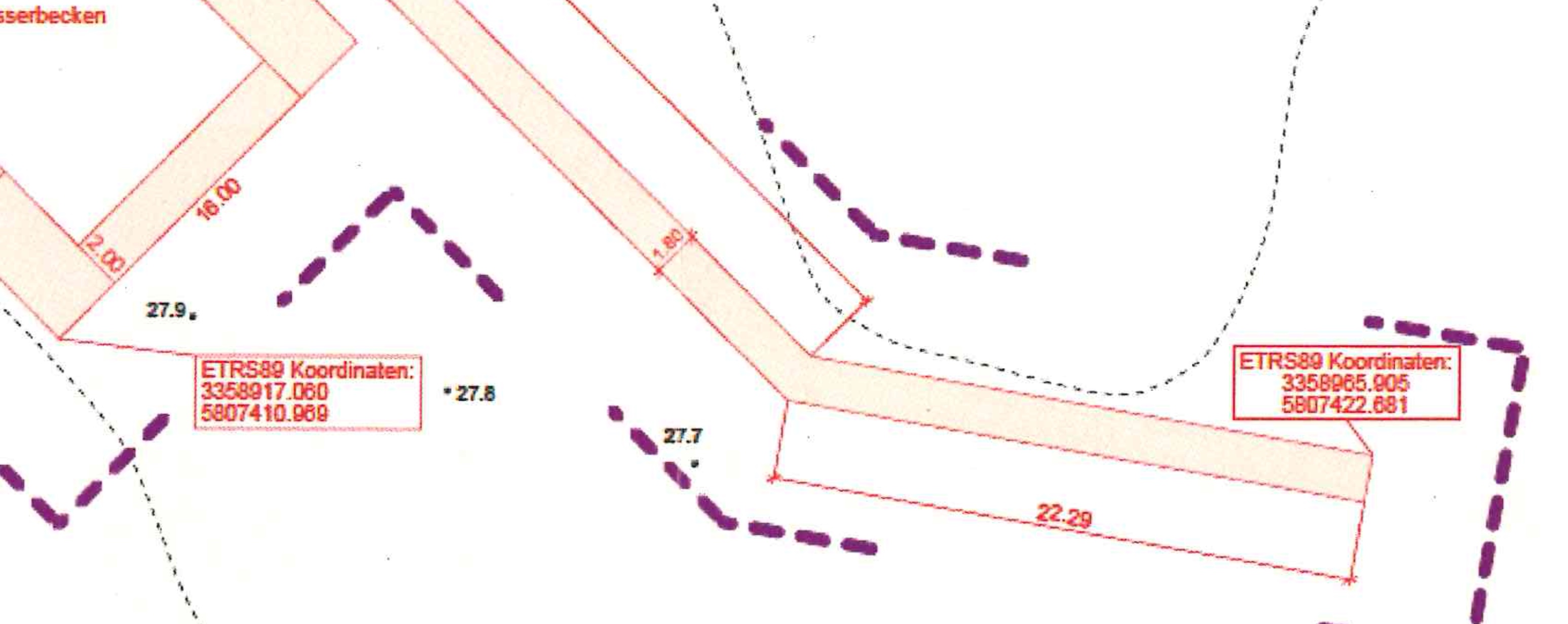
Good morning! I am working on a project at the moment where I have some very precise geolocation markers that I could use to correctly position my model into said location. They look like this:
I’ve gone through the steps to download and import the map data with the “add geolocation” feature. So I see the image of the terrain (Tag “Location Snapshot” and I could sort of rotate and position the model by “feel”.
installed it, it works. Now I am basically failing at converting data from one coordinate system to another. So the coordinates that Sketchup uses are the same that google maps uses - meaning if I punch in the coordinates 12.926266E, 52.399050N that I get from the “Coords-Tag-from-Datum” in to google maps I get exactly to that spot. Nice and sweet. HOWEVER - The coordinates on the plan I got are written down in a system called the ETRS89 coordinate-system and I have failed to find a straight-forward way to convert ETRS89 3358917.060 5807410.969 into that Google/Sketchup coordinate-system in order to figure out where to place my objects in the model. I might ask the office that made the plans to convert it for me but I still kinda would like to close that knowledge gap of mine anyway…
You are right, it is not very straightforward. Countries have their own implementations of the ETRS89 system to minimize the local errors. Try your national survey, they might have a conversion routine available.