I have a contour lines from an autocad drawing i’m trying to bring into sketchup. It looks good until I run the “from contours” in the sandbox tools. It works somewhat, but i have hundreds of icecycle looking lines that make it unusable. I read thru the forums and looked though the extension warehouse and tried “simplify contours” and “edge tools” with a variety of parameters. Both have some effect, but don’t solve the problem. In reading I also cleaned up the file i was trying to import with everything just on one layer. From reading the form I tried the check boxes in the “options” box together and separately. Anyone have in helpful hints.
Patcontours imported.skp (2.9 MB)
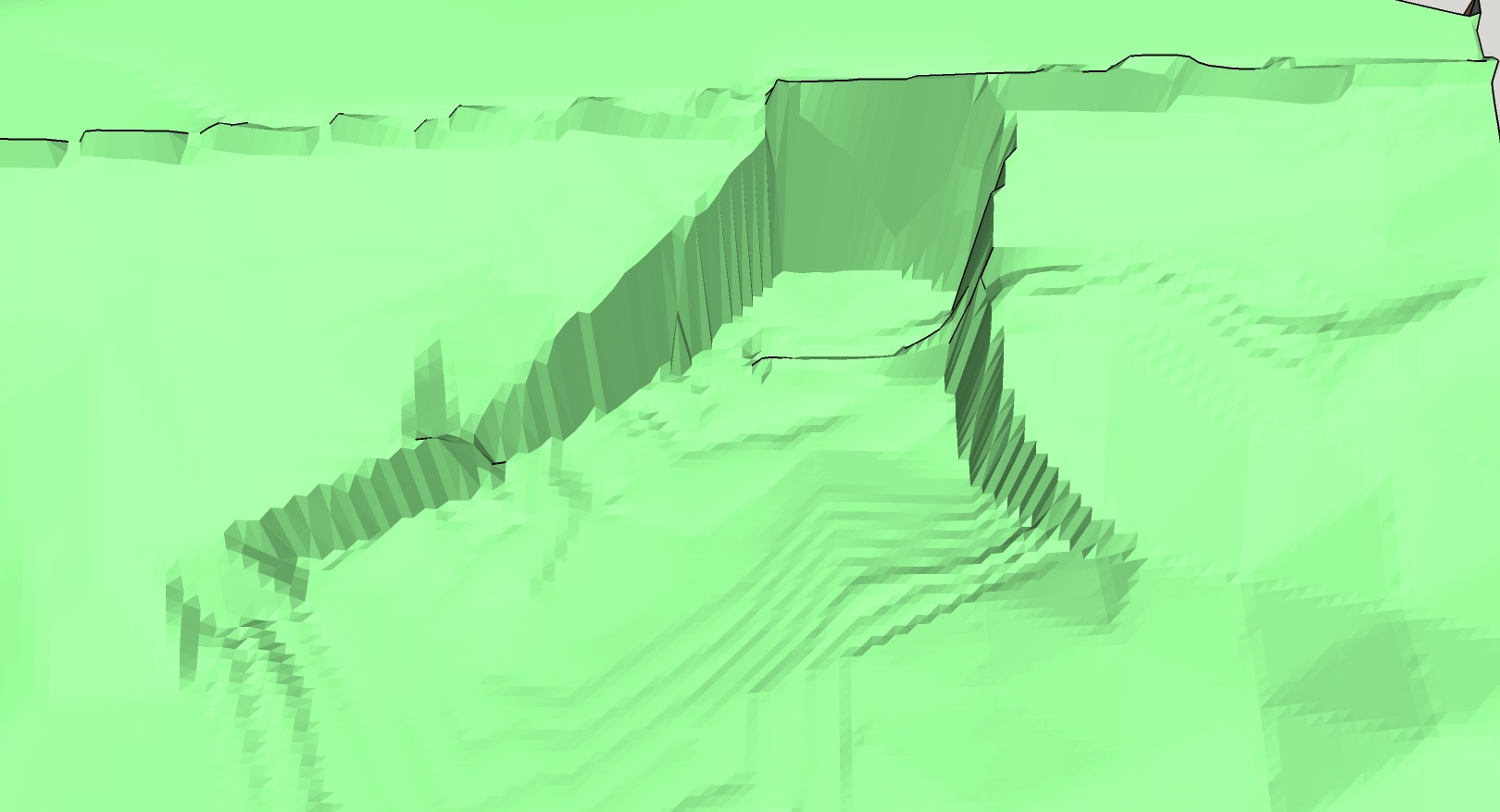
Here is the file with the contours after using the “from contours”. I had to use pdf because the file size is too large. You should get the idea of what Sketchup does.
contours rendered.pdf (95.8 KB)
Without seeing the original acad file I can only speculate, and the importer or from contours might be to blame. But the skp and pdf you show look to me like there are issues in the original data. There are “cliffs” where not only does the elevation change abruptly, the number of contours approaching the cliff from above is very different from the number below. That is, it is hard to imagine how the two surfaces could meet cleanly.
The From Contours tool has a very hard time with sheer vertical dropoffs. You might have better success using Toposhaper. Free SketchUcation registration required.
-Gully
1 Like
Thanks for the responses. Here is the acad file. It looks like it’s very good to me. All polylines and no errant lines. I’ll look for toptshaper and see if that works.
If the problem is steep changes I though stretching out flat might make it work better then compressing it back. It’d didn’t help. attached is the acad file i imported. It has just the contour lines and everything else deleted.
I have tried pretty hard to get this to work.
Pat
wingwall block 4.dwg (458.0 KB)
Pat
eDrawings also sees sharp vertical walls in that dwg. Are they what you are seeing when you work with the file?
There are some vertical or nearly vertical walls. the location is 39°04’36.8"N 94°37’07.5"W. There is a failing retaining wall from recent floods I was asked to look at.
I have been trying toposhaper and watching videos on how to use this morning. I have something a little better now, but not great. Seems somehow I should be able to eliminate the contours on the vertical surfaces and hand draw those in. they are concrete walls.
Pat