First, thanks for some great answers over the years from this community. I now have a conundrum that has not been discussed and I’d appreciate your help working through this.
As a land surveyor, I’m working with contours and point data in Civil 3D, and I need to bring them into SketchUp with an accurate geolocation that will ideally allow me to export a .kmz and view in Google Earth. My .dwg is properly georeferenced in a state plane coordinate system, and I’d like to maintain that through this process if possible. Exporting a .kmz from AutoCAD does land in the correct location, though wrong altitude in Google Earth.
The first issue I’m having seems to be how to accurately geolocate within SketchUp, so that I can tie my .skp to the coordinates in C3D. Any advice on how to locate based on lat/long, utm, etc would be appreciated.
If I simply import contours from C3D to SU and then to GE, my world jumps from Colorado to South Dakota.
Ultimately, the goal is to combine survey data from our office, with sketchup data from the architects to establish view corridors so that the surrounding mountains can be seen from the site through the removal of as few trees as possible.
Both SU and GE use the NAD 83 … The State plane and UTM are basically conformal transformation used in mapping. and of course have some errors associated with them. State plane is usually used in the CONOUS and UTM other places. In addition because of the spherical curve fits in the NAD 83 and how sea level is defined some locations change their sea level info for there locales since the NAD 83 datum does not account for all the parameters for say things like bridge clearance ( boats) etc. for tides etc.
My machine must have some issues it does not include the geo info discussed above.
If you are going to input geo data into SU then the first step is to convert you data from UTM to NAD 83. There are some free programs to do , TRIMBLE sends correct data over phone lines also, could not find my info that maybe for NAD 27. From you post I assume you need not worry about the sea level issue.
FYI 15. Control Points and Datum Shifts | The Nature of Geographic Information
I assume you use this site OPUS: the Online Positioning User Service, process your GNSS data in the National Spatial Reference System which I assume uses differential GPS and should be very accurate.
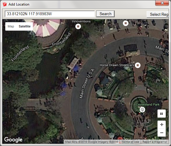
I’ve never used the advanced geo-location setting available in the Model info pane, but it centers the selected area exactly on the co-ordinates I give it:
I would suggest you do not use the Add Location feature to geo-locate the model.
Geo-locate the model manually.
Click … Window > Model Info > Geo-location > Advanced Settings - Set Manual Location
The Set Manual Geo-location dialog opens.
Therein:
The Country Field is merely a label.
The Location Field is merely a label.
Enter Latitude and Longitude in 6-place Decimal Degree format.
The L,Lo coordinates of a geo-located SketchUp model coincide with SU’s World Origin [0,0,0]
By default, in a manually geo-located SU model, true north coincides with the +y solid green axis.
Such is NOT the case in a model geo-located via the Add Location feature, which imports terrain geometry and imagery from Google.
That is, upon using the Add Location feature you’ll find true north rotated slightly away from the default +y solid green axis.
The first step is to decide where the " truth" lies. For example when you download SU it comes with data tables from The International Oil and Gas Producer related to geo-location type of info that I assume the program uses some it way:confused: The Federal Government controls the info for cites ( http://geonames.usgs.gov/) , and the USGS data sheets for location monuments in and around those places and the accuracy of , stability etc of same. I my self would not feel comfortable using Goolgle, any software program that has not been error tested to at least to the accuracy I need. The US government over the years has controlled the accuracy of over head imagery although I think they have now ok’d accuracy down to about 250 cm but that may not be on line since it takes around 5 years to design and launch new sats.
The OPUS link( 2nd) is for processing of differential GPS where accuracy in the 3 cm range can be obtained. My guess is it is better than that now. Trimble has a subscription service it is my understanding to can get near real time info vs OPUS.
I would strongly recommend you read that first link above and follow the examples and it will take you through the steps to help your under stand.
Correction; The data tables I ref are in Google Earth vs SU as stated.
The following is location as installed on my machine C:\Program Files (x86)\Google\Google Earth Pro\client. There are a number of CSV spread sheet files;
I implied Trimble uses OPUS really mistake on my part
Links to IOPG http://www.iogp.org/#* ; http://www.iogp.org/Geomatics