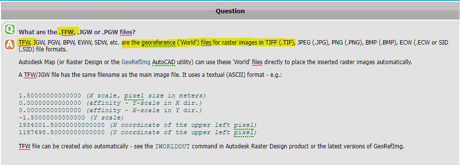
A surveyor performed a drone survey of our site. We received the files from them which include the separate CAD lines and surface files, and an aerial image. .dwg & the image has 2 files .tif & .tfw
I only have CAD LT & SU Pro 2023. The .dwg’s don’t have a box referencing where the image fits.
I know how to import the .dwg to it’s correct co-ords.
Is there a way of importing the image so it automatically fits in the right place?
I’ve done the manipulation into the right place but this takes time and isn’t accurate.
thanks you generous lot, another tick for SU is the awesome community!
If the files were produced at the same time, they should import to the same location relative to each other.
If you have a ‘Master’ file with items already scaled, you can draw some reference lines on it (say around a house). Then copy and paste in place your reference lines to another ‘scratch’ file. Import files to the ‘scratch’ file and scale/position to the reference lines. You can then copy and paste in place back into your ‘Master’ file.