Automatic Architectural Survey?

Hi all

Where I’m making my internship in architecture two people have spent perhaps a full week in total measuring an old office building to get proper drawings of it as it is now before design any additions/modifications to it. The building has numerous staircases, a tower, an air raid shelter from WWII and is immensely complex. There must be a simpler way of doing this than manually sketch plans and sections and measure all relevant dimensions with a laser measuring device and then draft drawings from that.

I’m really new to surveying but I’m thinking there must be a simpler and faster way. Is it possible today to generate accurate 3D models automatically from a series of 2D images, kind of like taking a 3d photography?

Feel free to post links or even just relevant search terms to get me in the right direction!

I’ve just found Undet which seams to be a big step in the right direction http://www.undet.com/software/for-sketchup-v1/.

Does anyone have any experience in using it? Where do I start? What kind of hardware is needed for this and is it possible to rent it? As an intern I can’t just go out and spend company money on my own :stuck_out_tongue: .

If I do not get it wrong, you’re talking about something like that.

1 Like

Measured drawings are tedious to prepare but the manual process records more that just the dimensions of the space.

A pointscan of a space may give you too much detail but not enough knowledge.

When I used to measure up existing buildings I was also :-

1] Rationalising [rounding] dimensions to an accuracy needed
2] Recording detials
3] Noting Defects
4] Being selective - documenting only what is essential

ie embedding your own expertise into the information

The pointcloud scan would be a wonderful reference document,

but not one to form the basis for developing efficient future documents.

Having said that, I recently purchased a Ricoh THETA360 camera and

it is proving brilliant on site visits recording complete spaces with one 360 image

and with google photos , upload onto a folder and share with the entire project team.

an example link below to a current project

https://photos.app.goo.gl/rjMFsA9l2sXYckSp2

1 Like

I never tried this, but it looks interesting:

This also is interesting:

gsharp is absolutely correct…there’s no major shortcut. ■■■■ data in = ■■■■ data out. Its easy for a machine to gather too much data …for example it collects the position of every fibre on a rug, but can’t recognize that the rug is a different object to the carpet it is placed on.

Were you using a hand-held laser measuring tool, or a tripod-mounted Total Station? Moving from a manual measurement tool to a survey–grade process is quite a big step. There are hand-held laser measurement devices that record points into a 3d model format which is very handy, but is also very prone to user error.
For pro tools there are a few options:

Option 1: Photo based survey. Hardware such as the Trimble V10 Image Rover is a photo-based survey tool. It really works best for less complex spaces. Exteriors and larger volumes are fine but detailed areas are too clumsy. Using Trimble business Centre, you can import a reasonable 3d model and begin refining it. (Trimble Vision I think is the software that connects to Sketchup)

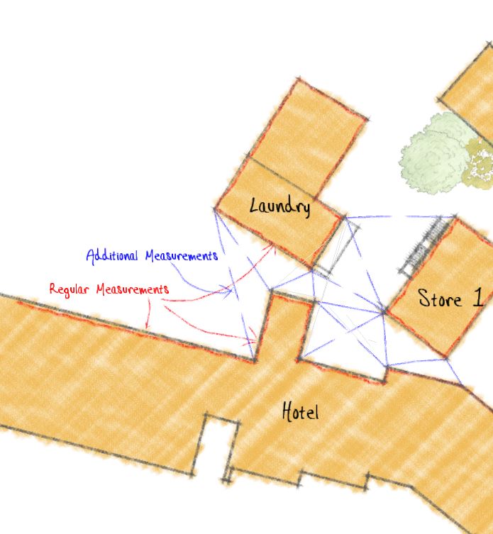
Option 2: Traditional survey points using Total Station (either robotic Trimble S8 or manual TS3, etc). You get a lot of dots, but the dots are strategically placed where you want them - corners of walls, windows, etc. Then you use Sketchup to connect the dots.

Option 3: Laser scanning using a scanning total station (Trimble SX10)…this gives you zillions of Dots( as well as reference photos). with the point cloud you can use a modelling package to automatically detect planes, surfaces, and reduce the number of points…then you can bring it into a modelling package. There’s a lot of organisation to be done within the model to ensure accuracy. Trimble Scan explorer is a good point cloud viewer with a sketchup plugin which could help for small projects.

Pro-grade survey data collection requires specialist training, expensive equipment and plenty of hands-on modelling to clean up the resultant survey data. You also want very powerful PCs/servers and loads of SSD capacity. A 3d modeller has a great responsibility to be accurate because engineers, builders, etc will be working to your interpretation of the raw surveyed data. Software is getting better at cleaning up raw data and creating a 3d model interpretation of it,but it’s still new tech.

Unfortunately Sketchup is not the right tool to model using raw survey data like Point Clouds or photoscans so you’ll be looking to other applications (12D or possibly Revit, TBC) to do this. Sketchup can take pieces of a survey model and create basic objects like walls, furniture, to be placed back into a survey/structural design model, etc, but that’s about it.

In my job I sometimes have to survey and model large existing trees. That can be a lot of “fun” . :stuck_out_tongue:

1 Like

Occipital is actually made for small homes, not optimized for large buildings. We used the Matterport 3D camera. Handles much larger datasets for commercial building scans. There is also the Leica total stations that output rcp files. However we outsourced this service as the scanners cost a Ton. The rcp files we model over in revit as that point cloud import is built in. Prior to this we can reduce the number of points using Recap then reduce the visibility of the cloud using section boxes in revit. It cost A LOT but it was more efficient way of piecing a model together.

Before this I was doing research similar to you…Some stuff I have tried: Memento photo stitch with Google Earth, Recap photo stitch with a drone, Infraworks data extraction. The drone mesh stitches could not capture enough points we could use, so site measures and total station scans was where we ended up.

Thanks all!

Automatic architectural survey was probably not the right title for the post. I know a man made drawing, whether it is a technical drawing or a piece of art, is very different from o photography in the sense that you chose exactly what to include and what to leave out. The final drawings will be made manually in any case.

The problem with the current method (laser distance measuring device + pen and paper) is that is is very time consuming and quite error prone. You may not notice two walls aren’t actually parallel when on site. Then when drawing everything to scale back at the office (which is located in another town than the building) the measurements just don’t always add up.

There is also a problem with rounding errors. We round everything to 5 mm but when measuring a long array of rooms at each floor the staircases don’t line up perfectly.

This is why I’d like to have a kind of “3D photography” that contains just as much information possible, whether it will be included or not in the final drawing. I would also be very handy if several rooms could be accurately stitched together to a larger model where I can measure right through solid walls.

Regarding your problems with rounding errors, one of the basic principles of surveying is that you survey from the “whole to the part”. First establish the extent of the building, say by measuring all the external walls, when you plot this shape, you should end up very close to your first point if all the measurements are correct. This “frame” will help control the propagation of errors. If all you have is a handheld laser it’s vital to take diagonal measurements as old buildings are seldom square, also multiple measurements to walls through open doors from other rooms. In your case the stairs are known to be vertically above on another so use these as fixed control points and measure from these to locate the other features-doors/windows/interior walls etc. OrthoGraph is a nice app that you might have a look at…OrthoGraph I multi-platform building survey app - YouTube

1 Like

Hi Eneroth
I’m an architect. Most of my work is extensions to houses.
I use a Leica D110. I’m considering an S910, it has the ability to measure several points from a single location and export them as a .dxf - which I can then import to SketchUp and join the points.
The BLK360 and 3D Disto will probably do what you want. I suspect that they’ll produce models with too many triangles - and they’re expensive.
Check out this site: https://lasers.leica-geosystems.com/uk/
I’ve experimented with Scanect: http://skanect.occipital.com/
And Agisoft: http://www.agisoft.com/
If I were commissioned to work on a job like you describe, then I’d outsource the surveying work to a specialist surveying company - In the UK (and Greece, where I used to live), there are companies that specialise in surveying. Because that’s all they do, they have the equipment that’s needed.
Best wishes
Andrew

3 Likes

Hello! I’m the product manager for Canvas at Occipital - it looks like a few other folks already shared some info about us, but feel free to shoot me a DM if you have any questions about Canvas or if I can be helpful finding the right solution. @JV_FletcherBuilding is correct that the product is geared toward residential spaces vs. large commercial buildings. That said, we do have a lot of customers that use it in commercial, and we’ve seen some pretty big houses scanned, so it just depends on the situation.

HI Eneroth3

The company I work with has had great results using Undet. We usually scan industrial process plants with towers, stair cases, etc. We’ve been using this for 2 years now. The 3d’d section box in undet is very effective at parsing out the scan data. That said, through the whole process I still need to take notes, carry a disto, and know what I’m looking at.

Our usual workflow is:
Scan a building using Faro Focus 3d Scanner
Register in Trimble Realworks using and Export a .PTS file
Index the PTS in Undet.
Model in Sketchup over the Points cloud.

For one time use, hiring someone to scan the building may be most cost effective. Most folks I’ve worked with on the east coast are able to scan, register, and export a PTS file.
I’d recommend going with the person scanning so you can make sure your getting what you need. The scanners are line of sight only, and more scans the better.

Once you have a PTS file, I’d recommend the month long subscription. A moderately powerful windows machine is more than sufficient to model in sketchup with a points cloud active.

1 Like

Hi Chris, typically what density is your point cloud data? i’ve struggled getting sketchup to open/work with a large data set. (eg a building or an outdoor car park area)
I’ll give Undet a try as it looks very promising.

I find modelling the building while IN the building is the best approach…(laptop in the field for a few hours).
Does the Faro Focus take reference photos as it goes? I’ve also found those to be very helpful (the 360 pano ones).

I’ve had great success with Undet v1. in a historical reconstruction project. Can recommend it.
v.2 really simplifies face creation for normal walls. For not so straight features I used TopoShaper plugin to connect the 3D point cloud.

1 Like

Hey @AK_SAM

Can you give us a review of how you find Undet if you have done this please?.

Looking into the same thing with point clouds, Have to buy a scanner first which is a major hurdle.

This topic was automatically closed 91 days after the last reply. New replies are no longer allowed.